This weather event on July 21, 2024 includes:
3 states
32 counties,
14 cities,
and 84 zip codes.
There were 93 total properties that were impacted and have possible damage.
States Impacted By Hail On July 21, 2024
Colorado
·
Nebraska
·
Wyoming
Counties Impacted By Hail On July 21, 2024
Adams, CO
·
Arapahoe, CO
·
Denver, CO
·
Douglas, CO
·
Elbert, CO
·
Grand, CO
·
Larimer, CO
·
Logan, CO
·
Morgan, CO
·
Park, CO
·
Sedgwick, CO
·
Washington, CO
·
Weld, CO
·
Yuma, CO
·
Banner, NE
·
Box Butte, NE
·
Cheyenne, NE
·
Dawes, NE
·
Deuel, NE
·
Garden, NE
·
Keith, NE
·
Kimball, NE
·
Morrill, NE
·
Scotts Bluff, NE
·
Sheridan, NE
·
Sioux, NE
·
Albany, WY
·
Carbon, WY
·
Goshen, WY
·
Laramie, WY
·
Niobrara, WY
·
Platte, WY
Cities Impacted By Hail On July 21, 2024
Aetna Estates, CO
·
Akron, CO
·
Aurora, CO
·
Berea, NE
·
Chappell, NE
·
Denver, CO
·
Fleming, CO
·
Lakeview North, WY
·
Lodgepole, NE
·
Nunn, CO
·
Parker, CO
·
Slater, WY
·
Stonegate, CO
·
Wheatland, WY
Zip Codes Impacted By Hail On July 21, 2024
69122
·
69125
·
69128
·
69129
·
69131
·
69141
·
69145
·
69147
·
69148
·
69154
·
69301
·
69331
·
69334
·
69337
·
69339
·
69340
·
69346
·
69348
·
69351
·
69354
·
69356
·
69357
·
69358
·
80011
·
80018
·
80019
·
80107
·
80134
·
80137
·
80138
·
80249
·
80432
·
80440
·
80442
·
80446
·
80478
·
80482
·
80532
·
80535
·
80536
·
80549
·
80610
·
80611
·
80612
·
80648
·
80650
·
80720
·
80722
·
80723
·
80726
·
80727
·
80728
·
80737
·
80743
·
80744
·
80745
·
80749
·
80751
·
80759
·
80801
·
80815
·
82001
·
82007
·
82009
·
82050
·
82051
·
82058
·
82059
·
82061
·
82070
·
82072
·
82081
·
82084
·
82201
·
82210
·
82213
·
82219
·
82221
·
82225
·
82240
·
82329
·
69149
·
69345
·
80729
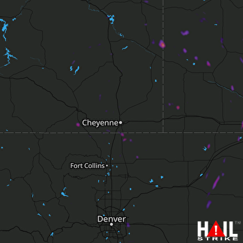 CHEYENNE (KCYS) RADAR

