This weather event on July 20, 2024 includes:
1 states
36 counties,
8 cities,
and 74 zip codes.
There were 754 total properties that were impacted and have possible damage.
States Impacted By Hail On July 20, 2024
Texas
Counties Impacted By Hail On July 20, 2024
Andrews, TX
·
Borden, TX
·
Callahan, TX
·
Coke, TX
·
Coleman, TX
·
Crane, TX
·
Crockett, TX
·
Crosby, TX
·
Dickens, TX
·
Eastland, TX
·
Ector, TX
·
Fisher, TX
·
Garza, TX
·
Glasscock, TX
·
Haskell, TX
·
Howard, TX
·
Irion, TX
·
Jones, TX
·
Kent, TX
·
Martin, TX
·
Midland, TX
·
Mitchell, TX
·
Nolan, TX
·
Pecos, TX
·
Reagan, TX
·
Runnels, TX
·
Scurry, TX
·
Shackelford, TX
·
Stephens, TX
·
Sterling, TX
·
Stonewall, TX
·
Taylor, TX
·
Throckmorton, TX
·
Tom Green, TX
·
Upton, TX
·
Val Verde, TX
Cities Impacted By Hail On July 20, 2024
Albany, TX
·
Gail, TX
·
Lake Colorado City, TX
·
Midland, TX
·
Odessa, TX
·
Rotan, TX
·
San Angelo, TX
·
Sweetwater, TX
Zip Codes Impacted By Hail On July 20, 2024
76424
·
76430
·
76435
·
76454
·
76483
·
76491
·
76828
·
76901
·
76903
·
76904
·
76905
·
76908
·
76932
·
76935
·
76939
·
76941
·
76943
·
76945
·
76951
·
76958
·
78840
·
79356
·
79370
·
79502
·
79504
·
79508
·
79510
·
79511
·
79512
·
79517
·
79518
·
79520
·
79526
·
79527
·
79528
·
79532
·
79535
·
79536
·
79537
·
79543
·
79545
·
79546
·
79548
·
79549
·
79556
·
79562
·
79565
·
79566
·
79567
·
79602
·
79603
·
79701
·
79703
·
79705
·
79706
·
79707
·
79714
·
79720
·
79731
·
79738
·
79739
·
79744
·
79748
·
79749
·
79752
·
79765
·
79766
·
79778
·
79782
·
79755
·
79713
·
79601
·
76933
·
76471
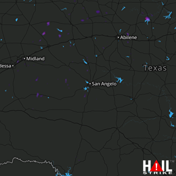 SAN ANGELO (KSJT) RADAR

