This weather event on July 20, 2024 includes:
3 states
26 counties,
15 cities,
and 62 zip codes.
There were 37 total properties that were impacted and have possible damage.
States Impacted By Hail On July 20, 2024
Georgia
·
North Carolina
·
South Carolina
Counties Impacted By Hail On July 20, 2024
Bryan, GA
·
Bulloch, GA
·
Candler, GA
·
Chatham, GA
·
Effingham, GA
·
Emanuel, GA
·
Liberty, GA
·
Lincoln, GA
·
Screven, GA
·
Tattnall, GA
·
Toombs, GA
·
Buncombe, NC
·
Columbus, NC
·
Randolph, NC
·
Bamberg, SC
·
Beaufort, SC
·
Berkeley, SC
·
Calhoun, SC
·
Colleton, SC
·
Dorchester, SC
·
Greenwood, SC
·
Hampton, SC
·
Jasper, SC
·
McCormick, SC
·
Orangeburg, SC
·
Williamsburg, SC
Cities Impacted By Hail On July 20, 2024
Beaufort, SC
·
Bent Creek, NC
·
Brunswick, NC
·
Burton, SC
·
Garden City, GA
·
Goose Creek, SC
·
Hardeeville, SC
·
Jacksonboro, SC
·
Laurel Bay, SC
·
Pooler, GA
·
Port Wentworth, GA
·
Ridgeland, SC
·
Rincon, GA
·
Savannah, GA
·
Whiteville, NC
Zip Codes Impacted By Hail On July 20, 2024
27205
·
28424
·
28433
·
28442
·
29107
·
30446
·
31326
·
28472
·
28704
·
28803
·
28806
·
29038
·
29048
·
29059
·
29113
·
29115
·
29135
·
29426
·
29436
·
29445
·
29448
·
29450
·
29461
·
29470
·
29472
·
29474
·
29479
·
29481
·
29485
·
29488
·
29510
·
29564
·
29819
·
29835
·
29848
·
29904
·
29906
·
29912
·
29916
·
29922
·
29927
·
29936
·
29940
·
29941
·
29944
·
29945
·
30401
·
30420
·
30436
·
30439
·
30450
·
30452
·
30458
·
30461
·
30467
·
30471
·
30817
·
31303
·
31322
·
31405
·
31407
·
31408
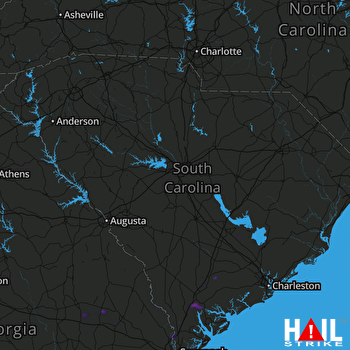 COLUMBIA (KCAE) RADAR

