This weather event on July 20, 2024 includes:
2 states
21 counties,
12 cities,
and 74 zip codes.
There were 1982 total properties that were impacted and have possible damage.
States Impacted By Hail On July 20, 2024
Minnesota
·
Wisconsin
Counties Impacted By Hail On July 20, 2024
Aitkin, MN
·
Becker, MN
·
Beltrami, MN
·
Carlton, MN
·
Cass, MN
·
Cook, MN
·
Crow Wing, MN
·
Hubbard, MN
·
Itasca, MN
·
Koochiching, MN
·
Lake, MN
·
Pine, MN
·
St. Louis, MN
·
Wadena, MN
·
Ashland, WI
·
Bayfield, WI
·
Douglas, WI
·
Iron, WI
·
Oneida, WI
·
Price, WI
·
Sawyer, WI
Cities Impacted By Hail On July 20, 2024
Barnum, MN
·
Baxter, MN
·
Big Lake, MN
·
Cloquet, MN
·
East Gull Lake, MN
·
Ely, MN
·
Esko, MN
·
Hoyt Lakes, MN
·
Kettle River, MN
·
Mahtowa, MN
·
Trommald, MN
·
Wrenshall, MN
Zip Codes Impacted By Hail On July 20, 2024
54514
·
54527
·
54546
·
54552
·
54564
·
54820
·
54821
·
54832
·
54838
·
54843
·
54849
·
54873
·
54874
·
55602
·
55604
·
55607
·
55614
·
55616
·
55702
·
55705
·
55711
·
55717
·
55718
·
55720
·
55723
·
55724
·
55725
·
55726
·
55731
·
55733
·
55736
·
55748
·
55749
·
55750
·
55752
·
55757
·
55760
·
55763
·
55765
·
55767
·
55769
·
55771
·
55779
·
55780
·
55782
·
55783
·
55787
·
55790
·
55792
·
55797
·
55798
·
55803
·
55811
·
56350
·
56401
·
56425
·
56431
·
56441
·
56444
·
56447
·
56464
·
56465
·
56469
·
56470
·
56627
·
56630
·
56639
·
56649
·
56653
·
56660
·
56661
·
56662
·
55707
·
54880
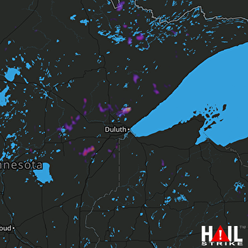 DULUTH (KDLH) RADAR

