This weather event on July 19, 2024 includes:
2 states
24 counties,
13 cities,
and 50 zip codes.
There were 270 total properties that were impacted and have possible damage.
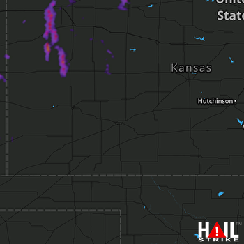 DODGE CITY (KDDC) RADAR
States Impacted By Hail On July 19, 2024
Colorado
·
Kansas
Counties Impacted By Hail On July 19, 2024
Baca, CO
·
Cheyenne, CO
·
Kiowa, CO
·
Prowers, CO
·
Decatur, KS
·
Finney, KS
·
Gove, KS
·
Graham, KS
·
Greeley, KS
·
Lane, KS
·
Logan, KS
·
Morton, KS
·
Ness, KS
·
Norton, KS
·
Rawlins, KS
·
Scott, KS
·
Sheridan, KS
·
Sherman, KS
·
Smith, KS
·
Stanton, KS
·
Thomas, KS
·
Trego, KS
·
Wallace, KS
·
Wichita, KS
Cities Impacted By Hail On July 19, 2024
Colby, KS
·
Gem, KS
·
Gove City, KS
·
Granada, CO
·
Greeley County unified government (balance), KS
·
Hill City, KS
·
Lenora, KS
·
Levant, KS
·
Norton, KS
·
Oberlin, KS
·
Russell Springs, KS
·
Sheridan Lake, CO
·
Winona, KS
Zip Codes Impacted By Hail On July 19, 2024
66967
·
67515
·
67518
·
67584
·
67629
·
67635
·
67638
·
67642
·
67643
·
67645
·
67650
·
67653
·
67654
·
67659
·
67701
·
67730
·
67732
·
67734
·
67735
·
67736
·
67737
·
67738
·
67743
·
67747
·
67748
·
67749
·
67752
·
67753
·
67757
·
67761
·
67762
·
67764
·
67839
·
67846
·
67861
·
67862
·
67863
·
67871
·
67879
·
67953
·
67954
·
80802
·
80810
·
81041
·
81047
·
81052
·
81071
·
81073
·
81084
·
81090

