This weather event on July 17, 2024 includes:
4 states
26 counties,
15 cities,
and 63 zip codes.
There were total properties that were impacted and have possible damage.
States Impacted By Hail On July 17, 2024
Arkansas
·
Missouri
·
Oklahoma
·
Texas
Counties Impacted By Hail On July 17, 2024
Baxter, AR
·
Benton, AR
·
Boone, AR
·
Carroll, AR
·
Clark, AR
·
Cleveland, AR
·
Dallas, AR
·
Grant, AR
·
Hempstead, AR
·
Hot Spring, AR
·
Howard, AR
·
Izard, AR
·
Lafayette, AR
·
Miller, AR
·
Nevada, AR
·
Ouachita, AR
·
Pike, AR
·
Van Buren, AR
·
Ozark, MO
·
Stone, MO
·
Latimer, OK
·
McCurtain, OK
·
Bowie, TX
·
Cass, TX
·
Lamar, TX
·
Red River, TX
Cities Impacted By Hail On July 17, 2024
Domino, TX
·
Emmet, AR
·
Friendship, AR
·
Gurdon, AR
·
Harrison, AR
·
Lewisville, AR
·
Malvern, AR
·
Midway, AR
·
Norfork, AR
·
Paris, TX
·
Perrytown, AR
·
Prescott, AR
·
Reno, TX
·
Texarkana, TX
·
Whelen Springs, AR
Zip Codes Impacted By Hail On July 17, 2024
65655
·
65681
·
71652
·
71701
·
71720
·
71722
·
71725
·
71726
·
71742
·
71743
·
71763
·
71772
·
71801
·
71834
·
71835
·
71837
·
71839
·
71845
·
71847
·
71852
·
71854
·
71857
·
71858
·
71860
·
71923
·
71940
·
71941
·
71962
·
72080
·
72084
·
72104
·
72129
·
72141
·
72150
·
72519
·
72601
·
72616
·
72623
·
72638
·
72658
·
72662
·
72722
·
72734
·
74563
·
74724
·
74745
·
74966
·
75416
·
75426
·
75460
·
75462
·
75501
·
75503
·
75551
·
75554
·
75556
·
75559
·
75568
·
75572
·
75574
·
74578
·
72537
·
72057
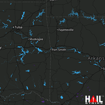 FORT SMITH (KSRX) RADAR

