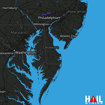
This weather event on July 17, 2024 includes:
4 states
16 counties,
21 cities,
and 79 zip codes.
There were 2792 total properties that were impacted and have possible damage.
States Impacted By Hail On July 17, 2024
Maryland
·
New Jersey
·
Pennsylvania
·
Virginia
Counties Impacted By Hail On July 17, 2024
Baltimore, MD
·
Baltimore, MD
·
Burlington, NJ
·
Bucks, PA
·
Chester, PA
·
Lancaster, PA
·
Monroe, PA
·
Montgomery, PA
·
Northampton, PA
·
Philadelphia, PA
·
Culpeper, VA
·
Norfolk, VA
·
Portsmouth, VA
·
Rappahannock, VA
·
Suffolk, VA
·
Warren, VA
Cities Impacted By Hail On July 17, 2024
Apple Mountain Lake, VA
·
Audubon, PA
·
Baltimore, MD
·
Beverly, NJ
·
Blue Bell, PA
·
Cornwells Heights, PA
·
Croydon, PA
·
Dundalk, MD
·
Eagleview, PA
·
Eddington, PA
·
Flourtown, PA
·
Honey Brook, PA
·
Norfolk, VA
·
Philadelphia, PA
·
Phoenixville, PA
·
Plymouth Meeting, PA
·
Portsmouth, VA
·
Rosedale, MD
·
Salunga, PA
·
Suffolk, VA
·
Wyndmoor, PA
Zip Codes Impacted By Hail On July 17, 2024
8010
·
8016
·
8046
·
8075
·
8077
·
17022
·
17512
·
17538
·
17545
·
17552
·
18013
·
18353
·
18354
·
18360
·
19020
·
19021
·
19031
·
19034
·
19038
·
19075
·
19114
·
19115
·
19116
·
19136
·
19154
·
19316
·
19320
·
19335
·
19341
·
19343
·
19344
·
19355
·
19422
·
19425
·
19442
·
19444
·
19453
·
19456
·
19460
·
19475
·
20106
·
21202
·
21222
·
21224
·
21225
·
21226
·
21230
·
21231
·
21237
·
22630
·
22642
·
22701
·
22714
·
22716
·
22718
·
22729
·
22733
·
22737
·
22741
·
22747
·
23433
·
23435
·
23436
·
23502
·
23503
·
23504
·
23505
·
23507
·
23508
·
23509
·
23511
·
23513
·
23517
·
23518
·
23703
·
19118
·
19403
·
19462
·
23707
 DOVER AFB (KDOX) RADAR

