This weather event on July 17, 2024 includes:
4 states
25 counties,
14 cities,
and 59 zip codes.
There were total properties that were impacted and have possible damage.
States Impacted By Hail On July 17, 2024
Arkansas
·
Louisiana
·
Mississippi
·
Texas
Counties Impacted By Hail On July 17, 2024
Union, AR
·
Acadia, LA
·
Ascension, LA
·
Cameron, LA
·
Catahoula, LA
·
East Baton Rouge, LA
·
East Feliciana, LA
·
Iberia, LA
·
Iberville, LA
·
Livingston, LA
·
Madison, LA
·
St. Helena, LA
·
St. Landry, LA
·
St. Martin, LA
·
St. Mary, LA
·
Tensas, LA
·
Vermilion, LA
·
West Baton Rouge, LA
·
West Feliciana, LA
·
Amite, MS
·
Franklin, MS
·
Jefferson, MS
·
Warren, MS
·
Wilkinson, MS
·
Orange, TX
Cities Impacted By Hail On July 17, 2024
Baton Rouge, LA
·
Central, LA
·
Centreville, MS
·
Clinton, LA
·
Franklin, LA
·
French Settlement, LA
·
Harrisonburg, LA
·
Monticello, LA
·
Opelousas, LA
·
Prairieville, LA
·
Sorrel, LA
·
St. Gabriel, LA
·
Walker, LA
·
Washington, LA
Zip Codes Impacted By Hail On July 17, 2024
39180
·
39631
·
39638
·
39645
·
39647
·
39668
·
39669
·
70422
·
70441
·
70443
·
70449
·
70453
·
70510
·
70526
·
70533
·
70535
·
70538
·
70544
·
70548
·
70560
·
70570
·
70577
·
70589
·
70643
·
70706
·
70714
·
70722
·
70726
·
70730
·
70733
·
70737
·
70739
·
70744
·
70748
·
70754
·
70761
·
70767
·
70770
·
70774
·
70775
·
70776
·
70777
·
70785
·
70789
·
70807
·
70810
·
70811
·
70814
·
70817
·
70818
·
71282
·
71322
·
71326
·
71340
·
71375
·
71765
·
77662
·
70769
·
70791
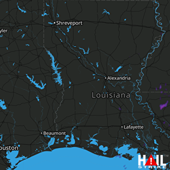 FORT POLK (KPOE) RADAR

