This weather event on July 15, 2024 includes:
2 states
33 counties,
19 cities,
and 82 zip codes.
There were 753 total properties that were impacted and have possible damage.
States Impacted By Hail On July 15, 2024
Colorado
·
Kansas
Counties Impacted By Hail On July 15, 2024
Cheyenne, CO
·
Kiowa, CO
·
Prowers, CO
·
Ellis, KS
·
Ellsworth, KS
·
Finney, KS
·
Gove, KS
·
Graham, KS
·
Gray, KS
·
Greeley, KS
·
Hamilton, KS
·
Kearny, KS
·
Kingman, KS
·
Lane, KS
·
Lincoln, KS
·
Logan, KS
·
Mitchell, KS
·
Ness, KS
·
Norton, KS
·
Osborne, KS
·
Ottawa, KS
·
Phillips, KS
·
Rooks, KS
·
Russell, KS
·
Saline, KS
·
Sheridan, KS
·
Sherman, KS
·
Smith, KS
·
Stanton, KS
·
Sumner, KS
·
Trego, KS
·
Wallace, KS
·
Wichita, KS
Cities Impacted By Hail On July 15, 2024
Barnard, KS
·
Beverly, KS
·
Dorrance, KS
·
Downs, KS
·
Edmond, KS
·
Greeley County unified government (balance), KS
·
Hays, KS
·
Kirwin, KS
·
Lincoln Center, KS
·
Lucas, KS
·
Luray, KS
·
Munjor, KS
·
Osborne, KS
·
Ransom, KS
·
Russell, KS
·
Russell Springs, KS
·
Sylvan Grove, KS
·
Tescott, KS
·
Utica, KS
Zip Codes Impacted By Hail On July 15, 2024
66951
·
67004
·
67031
·
67105
·
67106
·
67118
·
67401
·
67418
·
67420
·
67423
·
67425
·
67430
·
67437
·
67439
·
67452
·
67455
·
67473
·
67481
·
67484
·
67485
·
67490
·
67515
·
67518
·
67521
·
67556
·
67560
·
67572
·
67584
·
67601
·
67623
·
67626
·
67631
·
67634
·
67637
·
67639
·
67640
·
67642
·
67644
·
67645
·
67648
·
67649
·
67650
·
67651
·
67656
·
67658
·
67661
·
67663
·
67665
·
67669
·
67671
·
67672
·
67673
·
67674
·
67675
·
67735
·
67736
·
67738
·
67740
·
67748
·
67752
·
67758
·
67761
·
67762
·
67764
·
67835
·
67838
·
67839
·
67846
·
67850
·
67851
·
67855
·
67857
·
67860
·
67861
·
67862
·
67878
·
67879
·
80802
·
80810
·
81047
·
81052
·
81071
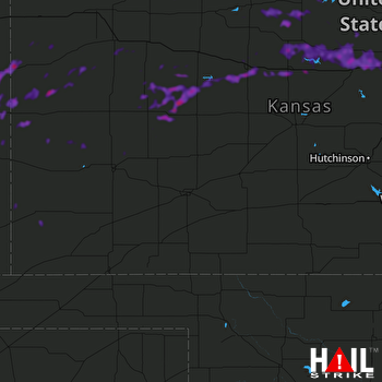 DODGE CITY (KDDC) RADAR

