This weather event on July 15, 2024 includes:
2 states
17 counties,
13 cities,
and 93 zip codes.
There were 2304 total properties that were impacted and have possible damage.
States Impacted By Hail On July 15, 2024
New York
·
Vermont
Counties Impacted By Hail On July 15, 2024
Albany, NY
·
Clinton, NY
·
Essex, NY
·
Franklin, NY
·
Fulton, NY
·
Rensselaer, NY
·
Saratoga, NY
·
St. Lawrence, NY
·
Warren, NY
·
Washington, NY
·
Addison, VT
·
Chittenden, VT
·
Franklin, VT
·
Grand Isle, VT
·
Lamoille, VT
·
Rutland, VT
·
Washington, VT
Cities Impacted By Hail On July 15, 2024
Altona, NY
·
Burlington, VT
·
Corinth, NY
·
Elizabethtown, NY
·
Jericho, VT
·
Mechanicville, NY
·
Milton, VT
·
Morrisonville, NY
·
Shelburne, VT
·
South Burlington, VT
·
Vergennes, VT
·
Whitehall, NY
·
Winooski, VT
Zip Codes Impacted By Hail On July 15, 2024
5401
·
5403
·
5404
·
5405
·
5408
·
5441
·
5445
·
5446
·
5448
·
5452
·
5454
·
5456
·
5457
·
5459
·
5462
·
5465
·
5468
·
5473
·
5474
·
5477
·
5482
·
5483
·
5486
·
5488
·
5489
·
5491
·
5492
·
5495
·
5660
·
5743
·
12023
·
12046
·
12059
·
12065
·
12067
·
12078
·
12118
·
12121
·
12134
·
12151
·
12154
·
12188
·
12193
·
12804
·
12816
·
12819
·
12822
·
12827
·
12828
·
12831
·
12833
·
12834
·
12835
·
12845
·
12846
·
12850
·
12859
·
12878
·
12885
·
12887
·
12901
·
12910
·
12912
·
12913
·
12918
·
12930
·
12932
·
12934
·
12935
·
12936
·
12943
·
12953
·
12962
·
12964
·
12970
·
12972
·
12976
·
12980
·
12981
·
12985
·
12989
·
12992
·
12993
·
12996
·
13625
·
13672
·
13676
·
13687
·
12955
·
12920
·
5673
·
5478
·
5458
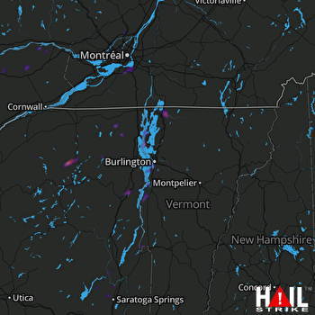 BURLINGTON (KCXX) RADAR

