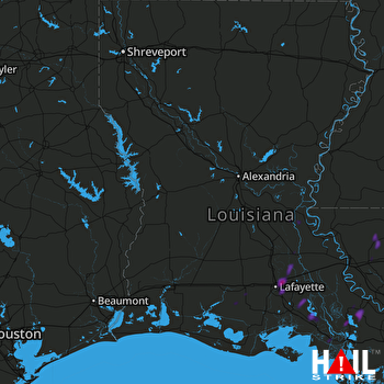
This weather event on July 15, 2024 includes:
2 states
18 counties,
18 cities,
and 45 zip codes.
There were 2011 total properties that were impacted and have possible damage.
States Impacted By Hail On July 15, 2024
Louisiana
·
Mississippi
Counties Impacted By Hail On July 15, 2024
Acadia, LA
·
Assumption, LA
·
Avoyelles, LA
·
Cameron, LA
·
East Baton Rouge, LA
·
East Feliciana, LA
·
Iberia, LA
·
Iberville, LA
·
Lafayette, LA
·
Livingston, LA
·
Pointe Coupee, LA
·
St. Helena, LA
·
St. Landry, LA
·
St. Martin, LA
·
St. Mary, LA
·
Vermilion, LA
·
Amite, MS
·
Jefferson, TX
Cities Impacted By Hail On July 15, 2024
Baldwin, LA
·
Bayou Corne, LA
·
Belle Rose, LA
·
Breaux Bridge, LA
·
Broussard, LA
·
Carencro, LA
·
Cecilia, LA
·
Charenton, LA
·
Denham Springs, LA
·
Gueydan, LA
·
Jeanerette, LA
·
Lafayette, LA
·
Loreauville, LA
·
Napoleonville, LA
·
New Iberia, LA
·
Paincourtville, LA
·
Sorrel, LA
·
Youngsville, LA
Zip Codes Impacted By Hail On July 15, 2024
39645
·
70339
·
70341
·
70390
·
70391
·
70393
·
70422
·
70441
·
70453
·
70501
·
70503
·
70507
·
70508
·
70512
·
70514
·
70517
·
70518
·
70520
·
70523
·
70526
·
70538
·
70544
·
70548
·
70552
·
70555
·
70559
·
70563
·
70582
·
70631
·
70645
·
70706
·
70715
·
70722
·
70726
·
70739
·
70747
·
70750
·
70753
·
70785
·
70788
·
71353
·
71369
·
70542
·
70592
·
70744
 FORT POLK (KPOE) RADAR

