This weather event on July 13, 2024 includes:
2 states
21 counties,
21 cities,
and 79 zip codes.
There were 655 total properties that were impacted and have possible damage.
States Impacted By Hail On July 13, 2024
Kansas
·
Missouri
Counties Impacted By Hail On July 13, 2024
Allen, KS
·
Anderson, KS
·
Bourbon, KS
·
Coffey, KS
·
Crawford, KS
·
Franklin, KS
·
Jewell, KS
·
Linn, KS
·
Miami, KS
·
Osage, KS
·
Osborne, KS
·
Shawnee, KS
·
Woodson, KS
·
Barton, MO
·
Bates, MO
·
Cass, MO
·
Henry, MO
·
Johnson, MO
·
Lafayette, MO
·
St. Clair, MO
·
Vernon, MO
Cities Impacted By Hail On July 13, 2024
Burr Oak, KS
·
Chilhowee, MO
·
Clinton, MO
·
Deepwater, MO
·
Drexel, MO
·
La Cygne, KS
·
Lake Lafayette, MO
·
Leeton, MO
·
Mapleton, KS
·
Metz, MO
·
Nevada, MO
·
Odessa, MO
·
Osborne, KS
·
Ottawa, KS
·
Piqua, KS
·
Rich Hill, MO
·
Rockville, MO
·
Schell City, MO
·
Urich, MO
·
Waverly, KS
·
Welda, KS
Zip Codes Impacted By Hail On July 13, 2024
64019
·
64020
·
64021
·
64037
·
64040
·
64061
·
64076
·
64096
·
64701
·
64720
·
64722
·
64724
·
64725
·
64726
·
64728
·
64730
·
64733
·
64735
·
64739
·
64740
·
64741
·
64742
·
64744
·
64747
·
64750
·
64759
·
64761
·
64762
·
64763
·
64765
·
64767
·
64770
·
64771
·
64772
·
64776
·
64778
·
64779
·
64780
·
64783
·
64784
·
64788
·
64790
·
65323
·
65336
·
65360
·
66010
·
66014
·
66015
·
66032
·
66039
·
66040
·
66053
·
66056
·
66067
·
66072
·
66075
·
66078
·
66091
·
66093
·
66095
·
66451
·
66510
·
66528
·
66546
·
66711
·
66749
·
66754
·
66758
·
66761
·
66783
·
66839
·
66852
·
66857
·
66871
·
66936
·
66941
·
67473
·
67485
·
64093
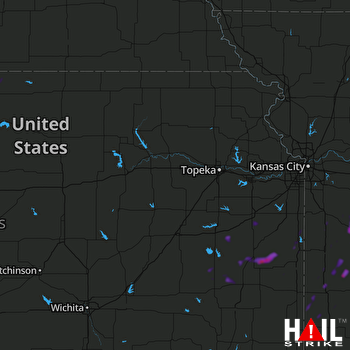 TOPEKA (KTWX) RADAR

