This weather event on July 11, 2024 includes:
3 states
25 counties,
23 cities,
and 78 zip codes.
There were 1107 total properties that were impacted and have possible damage.
States Impacted By Hail On July 11, 2024
Kansas
·
Missouri
·
Nebraska
Counties Impacted By Hail On July 11, 2024
Atchison, KS
·
Brown, KS
·
Butler, KS
·
Doniphan, KS
·
Ellsworth, KS
·
Harvey, KS
·
Jackson, KS
·
Leavenworth, KS
·
Lincoln, KS
·
Lyon, KS
·
Marion, KS
·
McPherson, KS
·
Nemaha, KS
·
Osage, KS
·
Russell, KS
·
Saline, KS
·
Sedgwick, KS
·
Buchanan, MO
·
Carroll, MO
·
Clay, MO
·
Clinton, MO
·
Platte, MO
·
Ray, MO
·
Jefferson, NE
·
Richardson, NE
Cities Impacted By Hail On July 11, 2024
Atchison, KS
·
Crystal Lakes, MO
·
Edgerton, MO
·
Elwood, KS
·
Ferrelview, MO
·
Highland, KS
·
Jansen, NE
·
Kansas City, MO
·
Lancaster, KS
·
Leavenworth, KS
·
Lehigh, KS
·
Peabody, KS
·
Platte City, MO
·
Roxbury, KS
·
Salina, KS
·
Smithville, MO
·
Tracy, MO
·
Troy, KS
·
Turney, MO
·
Wathena, KS
·
Weston, MO
·
Wilson, KS
·
Wood Heights, MO
Zip Codes Impacted By Hail On July 11, 2024
64024
·
64048
·
64060
·
64062
·
64079
·
64085
·
64089
·
64119
·
64153
·
64154
·
64155
·
64156
·
64157
·
64163
·
64164
·
64165
·
64166
·
64429
·
64439
·
64444
·
64465
·
64474
·
64477
·
64484
·
64492
·
64493
·
64503
·
64504
·
64624
·
64633
·
64668
·
66002
·
66016
·
66020
·
66023
·
66024
·
66027
·
66035
·
66041
·
66048
·
66087
·
66090
·
66094
·
66434
·
66509
·
66515
·
66532
·
66534
·
66856
·
66868
·
67026
·
67042
·
67060
·
67063
·
67073
·
67123
·
67154
·
67401
·
67416
·
67438
·
67439
·
67443
·
67448
·
67456
·
67470
·
67481
·
67483
·
67490
·
67634
·
67648
·
68352
·
68377
·
68433
·
64018
·
64098
·
66424
·
66866
·
67132
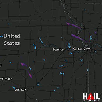 TOPEKA (KTWX) RADAR

