This weather event on July 10, 2024 includes:
3 states
25 counties,
25 cities,
and 83 zip codes.
There were total properties that were impacted and have possible damage.
States Impacted By Hail On July 10, 2024
Iowa
·
Illinois
·
Missouri
Counties Impacted By Hail On July 10, 2024
Lee, IA
·
Adams, IL
·
Brown, IL
·
Fulton, IL
·
Hancock, IL
·
Henderson, IL
·
Menard, IL
·
Peoria, IL
·
Pike, IL
·
Tazewell, IL
·
Warren, IL
·
Audrain, MO
·
Boone, MO
·
Clark, MO
·
Cooper, MO
·
Howard, MO
·
Lewis, MO
·
Macon, MO
·
Marion, MO
·
Monroe, MO
·
Pike, MO
·
Ralls, MO
·
Randolph, MO
·
Saline, MO
·
Shelby, MO
Cities Impacted By Hail On July 10, 2024
Atlanta, MO
·
Barry, IL
·
Bentley, IL
·
Bevier, MO
·
Bowling Green, MO
·
Camp Point, IL
·
Carthage, IL
·
Clark, MO
·
Elmer, MO
·
Elvaston, IL
·
Ethel, MO
·
Ferris, IL
·
Hamilton, IL
·
Hannibal, MO
·
Keokuk, IA
·
La Grange, MO
·
Loraine, IL
·
Louisiana, MO
·
Macon, MO
·
Media, IL
·
Monroe City, MO
·
Montrose, IA
·
Nauvoo, IL
·
Quincy, IL
·
Stronghurst, IL
Zip Codes Impacted By Hail On July 10, 2024
52619
·
52632
·
52639
·
61425
·
61454
·
61460
·
61478
·
61520
·
61533
·
61546
·
62301
·
62305
·
62312
·
62313
·
62320
·
62321
·
62324
·
62330
·
62334
·
62338
·
62340
·
62341
·
62343
·
62347
·
62349
·
62351
·
62354
·
62363
·
62367
·
62370
·
62373
·
62375
·
62376
·
62379
·
62380
·
62642
·
62675
·
63334
·
63339
·
63345
·
63352
·
63353
·
63382
·
63401
·
63430
·
63431
·
63436
·
63437
·
63441
·
63448
·
63456
·
63459
·
63462
·
63471
·
63530
·
63532
·
63534
·
63538
·
63539
·
63552
·
63557
·
63558
·
65230
·
65239
·
65240
·
65243
·
65244
·
65247
·
65250
·
65254
·
65258
·
65259
·
65260
·
65263
·
65265
·
65275
·
65282
·
65322
·
65347
·
61480
·
62356
·
62358
·
62360
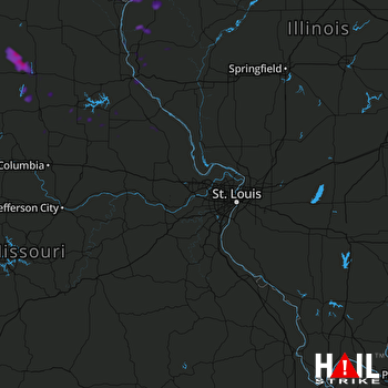 ST LOUIS (KLSX) RADAR

