This weather event on July 10, 2024 includes:
2 states
19 counties,
23 cities,
and 61 zip codes.
There were total properties that were impacted and have possible damage.
States Impacted By Hail On July 10, 2024
Iowa
·
Minnesota
Counties Impacted By Hail On July 10, 2024
Allamakee, IA
·
Bremer, IA
·
Butler, IA
·
Cerro Gordo, IA
·
Franklin, IA
·
Grundy, IA
·
Winnebago, IA
·
Winneshiek, IA
·
Wright, IA
·
Blue Earth, MN
·
Dakota, MN
·
Dodge, MN
·
Faribault, MN
·
Freeborn, MN
·
Le Sueur, MN
·
Rice, MN
·
Scott, MN
·
Steele, MN
·
Waseca, MN
Cities Impacted By Hail On July 10, 2024
Albert Lea, MN
·
Alexander, IA
·
Allison, IA
·
Clear Lake, IA
·
Cleveland, MN
·
Coulter, IA
·
Elko New Market, MN
·
Elysian, MN
·
Faribault, MN
·
Farmington, MN
·
Janesville, MN
·
Kasota, MN
·
Lakeville, MN
·
Leland, IA
·
Madison Lake, MN
·
Montgomery, MN
·
Morristown, MN
·
Owatonna, MN
·
Prior Lake, MN
·
Savage, MN
·
St. Clair, MN
·
Warsaw, MN
·
Waverly, IA
Zip Codes Impacted By Hail On July 10, 2024
50420
·
50428
·
50436
·
50441
·
50452
·
50453
·
50601
·
50602
·
50604
·
50619
·
50625
·
50666
·
50676
·
50677
·
50680
·
52101
·
52156
·
52172
·
55019
·
55020
·
55021
·
55024
·
55044
·
55046
·
55049
·
55052
·
55054
·
55060
·
55068
·
55088
·
55352
·
55372
·
55378
·
55924
·
55985
·
56001
·
56007
·
56009
·
56014
·
56017
·
56024
·
56028
·
56048
·
56050
·
56051
·
56052
·
56057
·
56058
·
56063
·
56068
·
56069
·
56071
·
56078
·
56080
·
56082
·
56093
·
56096
·
56097
·
56065
·
56037
·
50482
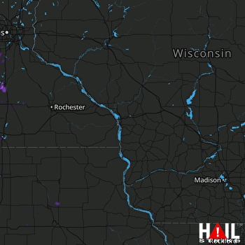 LA CROSSE (KARX) RADAR

