This weather event on July 9, 2024 includes:
3 states
14 counties,
28 cities,
and 47 zip codes.
There were 194 total properties that were impacted and have possible damage.
States Impacted By Hail On July 9, 2024
Illinois
·
Indiana
·
Kentucky
Counties Impacted By Hail On July 9, 2024
White, IL
·
Clark, IN
·
Floyd, IN
·
Harrison, IN
·
Jefferson, IN
·
Posey, IN
·
Breckinridge, KY
·
Carroll, KY
·
Henry, KY
·
Jefferson, KY
·
Logan, KY
·
Meade, KY
·
Oldham, KY
·
Trimble, KY
Cities Impacted By Hail On July 9, 2024
Brandenburg, KY
·
Buckner, KY
·
Campbellsburg, KY
·
Clarksville, IN
·
Doe Valley, KY
·
Ekron, KY
·
Elizabeth, IN
·
Glenview, KY
·
Goshen, KY
·
Hanover, IN
·
Hills and Dales, KY
·
Indian Hills, KY
·
Irvington, KY
·
Jeffersonville, IN
·
Laconia, IN
·
La Grange, KY
·
Louisville, KY
·
Madison, IN
·
Mauckport, IN
·
Mockingbird Valley, KY
·
New Albany, IN
·
Prospect, KY
·
River Bluff, KY
·
Riverwood, KY
·
Rolling Fields, KY
·
Shively, KY
·
Utica, IN
·
Westport, KY
Zip Codes Impacted By Hail On July 9, 2024
40006
·
40010
·
40011
·
40014
·
40025
·
40026
·
40045
·
40055
·
40059
·
40070
·
40075
·
40077
·
40108
·
40117
·
40142
·
40146
·
40176
·
40202
·
40203
·
40204
·
40206
·
40207
·
40210
·
40211
·
40212
·
40216
·
40222
·
40241
·
40258
·
41008
·
42256
·
47111
·
47112
·
47117
·
47129
·
47130
·
47135
·
47136
·
47142
·
47150
·
47224
·
47243
·
47250
·
47620
·
47633
·
62821
·
40031
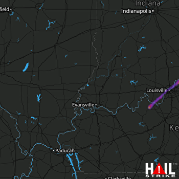 EVANSVILLE (KVWX) RADAR

