This weather event on July 8, 2024 includes:
3 states
19 counties,
31 cities,
and 75 zip codes.
There were 511 total properties that were impacted and have possible damage.
States Impacted By Hail On July 8, 2024
Illinois
·
Indiana
·
Michigan
Counties Impacted By Hail On July 8, 2024
Cook, IL
·
Vermilion, IL
·
Cass, IN
·
Elkhart, IN
·
Jasper, IN
·
LaPorte, IN
·
Newton, IN
·
Porter, IN
·
St. Joseph, IN
·
Warren, IN
·
White, IN
·
Berrien, MI
·
Calhoun, MI
·
Cass, MI
·
Gratiot, MI
·
Kalamazoo, MI
·
Kent, MI
·
Montcalm, MI
·
St. Joseph, MI
Cities Impacted By Hail On July 8, 2024
Aberdeen, IN
·
Alvan, IL
·
Belgium, IL
·
Berrien Springs, MI
·
Bismarck, IL
·
Bridgman, MI
·
Buchanan, MI
·
Carson City, MI
·
Catlin, IL
·
Coloma, MI
·
Danville, IL
·
Eau Claire, MI
·
Elkhart, IN
·
Greenville, MI
·
Hebron, IN
·
Indianola, IL
·
Kouts, IN
·
Lincolnwood, IL
·
Marcellus, MI
·
Michigan City, IN
·
New Carlisle, IN
·
Olivet, IL
·
Paw Paw Lake, MI
·
Ridge Farm, IL
·
Schoolcraft, MI
·
Simonton Lake, IN
·
Stanton, MI
·
Tilton, IL
·
Trail Creek, IN
·
Walkerton, IN
·
Westville, IL
Zip Codes Impacted By Hail On July 8, 2024
46310
·
46341
·
46347
·
46349
·
46350
·
46360
·
46365
·
46371
·
46383
·
46385
·
46514
·
46552
·
46574
·
46947
·
46978
·
47921
·
47926
·
47991
·
47993
·
48801
·
48811
·
48829
·
48838
·
48847
·
48856
·
48885
·
48886
·
48889
·
49022
·
49038
·
49047
·
49061
·
49067
·
49087
·
49095
·
49097
·
49098
·
49101
·
49102
·
49103
·
49106
·
49107
·
49111
·
49112
·
49113
·
49120
·
49125
·
49224
·
49237
·
49245
·
49319
·
49326
·
49347
·
60625
·
60630
·
60645
·
60646
·
60659
·
60712
·
60963
·
61811
·
61814
·
61817
·
61832
·
61833
·
61834
·
61841
·
61846
·
61850
·
61870
·
61876
·
61883
·
48888
·
48850
·
47950
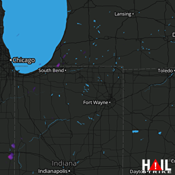 FORT WAYNE (KIWX) RADAR

