This weather event on July 7, 2024 includes:
1 states
24 counties,
29 cities,
and 82 zip codes.
There were 207 total properties that were impacted and have possible damage.
States Impacted By Hail On July 7, 2024
Iowa
Counties Impacted By Hail On July 7, 2024
Benton, IA
·
Black Hawk, IA
·
Butler, IA
·
Cedar, IA
·
Clayton, IA
·
Grundy, IA
·
Iowa, IA
·
Jasper, IA
·
Jefferson, IA
·
Johnson, IA
·
Keokuk, IA
·
Linn, IA
·
Lucas, IA
·
Mahaska, IA
·
Marion, IA
·
Marshall, IA
·
Monroe, IA
·
Polk, IA
·
Poweshiek, IA
·
Story, IA
·
Tama, IA
·
Wapello, IA
·
Warren, IA
·
Wayne, IA
Cities Impacted By Hail On July 7, 2024
Barnes City, IA
·
Beacon, IA
·
Deep River, IA
·
Grundy Center, IA
·
Guernsey, IA
·
Hamilton, IA
·
Harvey, IA
·
Hudson, IA
·
Knoxville, IA
·
Ladora, IA
·
Lovilia, IA
·
Lynnville, IA
·
Malcom, IA
·
Marengo, IA
·
Marshalltown, IA
·
Marysville, IA
·
Monroe, IA
·
Montezuma, IA
·
New Sharon, IA
·
Oskaloosa, IA
·
Packwood, IA
·
Pleasantville, IA
·
Prairie City, IA
·
Reasnor, IA
·
Swan, IA
·
Victor, IA
·
Waterloo, IA
·
Watkins, IA
·
West Amana, IA
Zip Codes Impacted By Hail On July 7, 2024
50027
·
50044
·
50049
·
50055
·
50057
·
50062
·
50104
·
50112
·
50116
·
50118
·
50119
·
50120
·
50135
·
50136
·
50138
·
50139
·
50143
·
50150
·
50153
·
50157
·
50158
·
50162
·
50166
·
50169
·
50170
·
50171
·
50207
·
50208
·
50214
·
50219
·
50225
·
50228
·
50232
·
50234
·
50237
·
50238
·
50242
·
50251
·
50252
·
50268
·
50609
·
50613
·
50621
·
50635
·
50638
·
50642
·
50647
·
50660
·
50669
·
50675
·
50701
·
52049
·
52052
·
52203
·
52209
·
52211
·
52221
·
52222
·
52251
·
52253
·
52301
·
52306
·
52316
·
52342
·
52347
·
52354
·
52355
·
52361
·
52501
·
52531
·
52534
·
52536
·
52553
·
52569
·
52576
·
52577
·
52580
·
52586
·
52755
·
50643
·
50256
·
50054
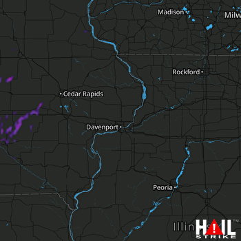 DAVENPORT (KDVN) RADAR

