This weather event on July 7, 2024 includes:
2 states
15 counties,
23 cities,
and 59 zip codes.
There were total properties that were impacted and have possible damage.
States Impacted By Hail On July 7, 2024
Kansas
·
Missouri
Counties Impacted By Hail On July 7, 2024
Bourbon, KS
·
Johnson, KS
·
Lincoln, KS
·
Morris, KS
·
Caldwell, MO
·
Carroll, MO
·
Clay, MO
·
Daviess, MO
·
Henry, MO
·
Jackson, MO
·
Johnson, MO
·
Lafayette, MO
·
Livingston, MO
·
Ray, MO
·
St. Clair, MO
Cities Impacted By Hail On July 7, 2024
Aullville, MO
·
Bates City, MO
·
Breckenridge, MO
·
Clinton, MO
·
Concordia, MO
·
Corder, MO
·
Crystal Lakes, MO
·
Dover, MO
·
Excelsior Springs, MO
·
Fort Scott, KS
·
Hardin, MO
·
Higginsville, MO
·
Homestead, MO
·
Kansas City, MO
·
Lake Lafayette, MO
·
Leawood, KS
·
Lexington, MO
·
Mayview, MO
·
Norborne, MO
·
Odessa, MO
·
Prairie Village, KS
·
Richmond, MO
·
Wood Heights, MO
Zip Codes Impacted By Hail On July 7, 2024
64019
·
64020
·
64021
·
64022
·
64024
·
64035
·
64036
·
64037
·
64040
·
64058
·
64061
·
64067
·
64071
·
64072
·
64074
·
64075
·
64076
·
64077
·
64085
·
64088
·
64093
·
64096
·
64097
·
64110
·
64114
·
64131
·
64601
·
64622
·
64624
·
64625
·
64633
·
64637
·
64638
·
64644
·
64648
·
64650
·
64654
·
64664
·
64668
·
64671
·
64735
·
64740
·
64761
·
64763
·
64776
·
65323
·
65336
·
65360
·
66206
·
66208
·
66701
·
66846
·
66849
·
67455
·
64001
·
64011
·
64062
·
64084
·
67481
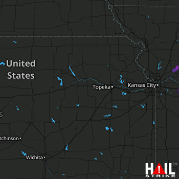 TOPEKA (KTWX) RADAR

