This weather event on July 7, 2024 includes:
1 states
21 counties,
39 cities,
and 65 zip codes.
There were total properties that were impacted and have possible damage.
States Impacted By Hail On July 7, 2024
Oklahoma
Counties Impacted By Hail On July 7, 2024
Bryan, OK
·
Caddo, OK
·
Canadian, OK
·
Carter, OK
·
Cleveland, OK
·
Garvin, OK
·
Grady, OK
·
Greer, OK
·
Harmon, OK
·
Johnston, OK
·
Kiowa, OK
·
Lincoln, OK
·
Love, OK
·
Marshall, OK
·
McClain, OK
·
Murray, OK
·
Pontotoc, OK
·
Pottawatomie, OK
·
Seminole, OK
·
Washita, OK
·
Grayson, TX
Cities Impacted By Hail On July 7, 2024
Ada, OK
·
Asher, OK
·
Bee, OK
·
Bessie, OK
·
Bethel Acres, OK
·
Blanchard, OK
·
Byars, OK
·
Byng, OK
·
Connerville, OK
·
Davis, OK
·
Dibble, OK
·
Earlsboro, OK
·
Etowah, OK
·
Fitzhugh, OK
·
Goldsby, OK
·
Johnson, OK
·
Katie, OK
·
Konawa, OK
·
Latta, OK
·
Marietta, OK
·
Milburn, OK
·
Mill Creek, OK
·
Noble, OK
·
Norman, OK
·
Pauls Valley, OK
·
Pink, OK
·
Purcell, OK
·
Roff, OK
·
Sasakwa, OK
·
Shawnee, OK
·
Slaughterville, OK
·
St. Louis, OK
·
Stratford, OK
·
Sulphur, OK
·
Tecumseh, OK
·
Tribbey, OK
·
Wanette, OK
·
Washington, OK
·
Wellston, OK
Zip Codes Impacted By Hail On July 7, 2024
73002
·
73010
·
73026
·
73030
·
73042
·
73047
·
73048
·
73051
·
73052
·
73059
·
73068
·
73074
·
73075
·
73080
·
73086
·
73093
·
73098
·
73401
·
73433
·
73446
·
73447
·
73448
·
73449
·
73450
·
73455
·
73460
·
73547
·
73554
·
73564
·
73571
·
73601
·
73622
·
73632
·
73651
·
73655
·
73661
·
73673
·
74701
·
74731
·
74748
·
74801
·
74804
·
74820
·
74825
·
74826
·
74831
·
74836
·
74840
·
74842
·
74843
·
74848
·
74849
·
74854
·
74856
·
74865
·
74867
·
74868
·
74871
·
74872
·
74873
·
74878
·
74881
·
73053
·
73095
·
74852
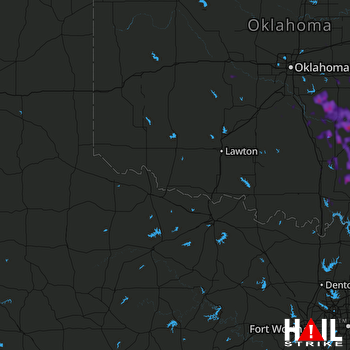 ALTUS AFB (KFDR) RADAR

