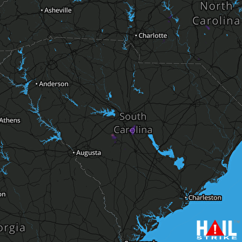
This weather event on July 6, 2024 includes:
3 states
24 counties,
18 cities,
and 65 zip codes.
There were 2581 total properties that were impacted and have possible damage.
States Impacted By Hail On July 6, 2024
Georgia
·
North Carolina
·
South Carolina
Counties Impacted By Hail On July 6, 2024
Jenkins, GA
·
Treutlen, GA
·
Washington, GA
·
Wilkes, GA
·
Wilkinson, GA
·
Davidson, NC
·
Moore, NC
·
Richmond, NC
·
Rowan, NC
·
Stanly, NC
·
Union, NC
·
Aiken, SC
·
Calhoun, SC
·
Chesterfield, SC
·
Fairfield, SC
·
Greenwood, SC
·
Kershaw, SC
·
Lancaster, SC
·
Lexington, SC
·
Newberry, SC
·
Orangeburg, SC
·
Richland, SC
·
Saluda, SC
·
Sumter, SC
Cities Impacted By Hail On July 6, 2024
Cayce, SC
·
Cherryvale, SC
·
Dobbins Heights, NC
·
Foxfire, NC
·
Gaston, SC
·
Hamlet, NC
·
Hopkins, SC
·
Lexington, SC
·
Millen, GA
·
Misenheimer, NC
·
New London, NC
·
Oak Grove, SC
·
Red Bank, SC
·
Richfield, NC
·
Ruby, SC
·
South Congaree, SC
·
Springdale, SC
·
West Columbia, SC
Zip Codes Impacted By Hail On July 6, 2024
27239
·
27242
·
27281
·
27376
·
28001
·
28071
·
28097
·
28103
·
28109
·
28110
·
28124
·
28127
·
28129
·
28137
·
28327
·
28338
·
28345
·
28374
·
28379
·
29009
·
29033
·
29038
·
29053
·
29061
·
29067
·
29070
·
29072
·
29073
·
29107
·
29108
·
29112
·
29115
·
29123
·
29135
·
29137
·
29138
·
29146
·
29154
·
29160
·
29164
·
29169
·
29170
·
29172
·
29180
·
29209
·
29355
·
29666
·
29709
·
29720
·
29728
·
29801
·
29805
·
29848
·
29856
·
30442
·
30457
·
30668
·
31002
·
31054
·
31082
·
31089
·
31090
·
30673
·
29741
·
28315
 COLUMBIA (KCAE) RADAR

