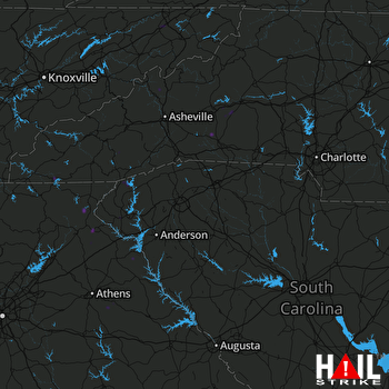
This weather event on July 5, 2024 includes:
4 states
29 counties,
13 cities,
and 62 zip codes.
There were 446 total properties that were impacted and have possible damage.
States Impacted By Hail On July 5, 2024
Georgia
·
North Carolina
·
South Carolina
·
Tennessee
Counties Impacted By Hail On July 5, 2024
Banks, GA
·
Elbert, GA
·
Franklin, GA
·
Habersham, GA
·
Hart, GA
·
Oglethorpe, GA
·
Rabun, GA
·
Stephens, GA
·
Burke, NC
·
Caldwell, NC
·
Cherokee, NC
·
Clay, NC
·
Henderson, NC
·
Jackson, NC
·
Macon, NC
·
Madison, NC
·
McDowell, NC
·
Mitchell, NC
·
Polk, NC
·
Rutherford, NC
·
Surry, NC
·
Transylvania, NC
·
Yancey, NC
·
Abbeville, SC
·
Anderson, SC
·
Greenville, SC
·
Oconee, SC
·
Pickens, SC
·
Sullivan, TN
Cities Impacted By Hail On July 5, 2024
Colonial Heights, TN
·
Crawford, GA
·
Golden Grove, SC
·
Hartwell, GA
·
Hayesville, NC
·
Mount Airy, NC
·
Murphy, NC
·
Piedmont, SC
·
Toccoa, GA
·
Valley Hill, NC
·
Westminster, SC
·
White Plains, NC
·
Williamston, SC
Zip Codes Impacted By Hail On July 5, 2024
28139
·
28167
·
28606
·
28655
·
28705
·
28714
·
28717
·
28723
·
28731
·
28734
·
28741
·
28753
·
28756
·
28761
·
28773
·
28774
·
28779
·
28783
·
28904
·
28906
·
29605
·
29620
·
29621
·
29626
·
29627
·
29654
·
29664
·
29669
·
29671
·
29673
·
29676
·
29684
·
29685
·
29686
·
29689
·
29691
·
29693
·
29697
·
30511
·
30521
·
30523
·
30547
·
30552
·
30563
·
30573
·
30576
·
30619
·
30627
·
30630
·
30635
·
30643
·
30648
·
30667
·
37656
·
37659
·
37660
·
37663
·
37664
·
27030
·
28645
·
28739
·
30577
 GREER (KGSP) RADAR

