This weather event on July 5, 2024 includes:
2 states
26 counties,
24 cities,
and 73 zip codes.
There were 192 total properties that were impacted and have possible damage.
States Impacted By Hail On July 5, 2024
Alabama
·
Mississippi
Counties Impacted By Hail On July 5, 2024
Chilton, AL
·
Choctaw, AL
·
Clay, AL
·
Coosa, AL
·
Etowah, AL
·
Greene, AL
·
Hale, AL
·
Marengo, AL
·
Pickens, AL
·
St. Clair, AL
·
Sumter, AL
·
Talladega, AL
·
Carroll, MS
·
Clarke, MS
·
Jasper, MS
·
Kemper, MS
·
Lauderdale, MS
·
Leake, MS
·
Madison, MS
·
Newton, MS
·
Noxubee, MS
·
Rankin, MS
·
Scott, MS
·
Smith, MS
·
Winston, MS
·
Yazoo, MS
Cities Impacted By Hail On July 5, 2024
Canton, MS
·
Carthage, MS
·
Coats Bend, AL
·
Collinsville, MS
·
Conehatta, MS
·
Cuba, AL
·
Demopolis, AL
·
Forest, MS
·
Gadsden, AL
·
Geiger, AL
·
Hollins, AL
·
Jemison, AL
·
Lake, MS
·
Lookout Mountain, AL
·
Meridian, MS
·
Nellieburg, MS
·
Newton, MS
·
Odenville, AL
·
Pickensville, AL
·
Sebastopol, MS
·
Stewartville, AL
·
Thorsby, AL
·
Toomsuba, MS
·
York, AL
Zip Codes Impacted By Hail On July 5, 2024
39189
·
39074
·
38901
·
35045
·
35046
·
35072
·
35082
·
35085
·
35120
·
35125
·
35136
·
35150
·
35151
·
35171
·
35183
·
35442
·
35443
·
35447
·
35459
·
35462
·
35470
·
35477
·
35901
·
35903
·
35904
·
36732
·
36740
·
36742
·
36744
·
36748
·
36776
·
36782
·
36904
·
36907
·
36908
·
36912
·
36919
·
36925
·
39039
·
39040
·
39045
·
39046
·
39051
·
39057
·
39092
·
39094
·
39117
·
39145
·
39146
·
39152
·
39153
·
39194
·
39301
·
39305
·
39307
·
39320
·
39325
·
39326
·
39327
·
39328
·
39330
·
39332
·
39335
·
39336
·
39338
·
39341
·
39345
·
39355
·
39358
·
39359
·
39361
·
39363
·
39364
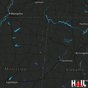 COLUMBUS AFB (KGWX) RADAR

