This weather event on July 5, 2024 includes:
4 states
32 counties,
22 cities,
and 75 zip codes.
There were 148 total properties that were impacted and have possible damage.
States Impacted By Hail On July 5, 2024
Colorado
·
New Mexico
·
Oklahoma
·
Texas
Counties Impacted By Hail On July 5, 2024
Baca, CO
·
Curry, NM
·
Guadalupe, NM
·
Harding, NM
·
Quay, NM
·
San Miguel, NM
·
Union, NM
·
Beckham, OK
·
Cimarron, OK
·
Dewey, OK
·
Ellis, OK
·
Greer, OK
·
Kiowa, OK
·
Roger Mills, OK
·
Washita, OK
·
Carson, TX
·
Collingsworth, TX
·
Dallam, TX
·
Donley, TX
·
Gray, TX
·
Hansford, TX
·
Hartley, TX
·
Hemphill, TX
·
Hutchinson, TX
·
Lipscomb, TX
·
Moore, TX
·
Ochiltree, TX
·
Oldham, TX
·
Potter, TX
·
Roberts, TX
·
Sherman, TX
·
Wheeler, TX
Cities Impacted By Hail On July 5, 2024
Borger, TX
·
Burns Flat, OK
·
Cactus, TX
·
Carter, OK
·
Channing, TX
·
Dalhart, TX
·
Dumas, TX
·
Elk City, OK
·
Erick, OK
·
Granite, OK
·
Higgins, TX
·
Leedey, OK
·
Logan, NM
·
Lone Wolf, OK
·
Nara Visa, NM
·
Sentinel, OK
·
Shamrock, TX
·
Stratford, TX
·
Sweetwater, OK
·
Texola, OK
·
Tucumcari, NM
·
Wheeler, TX
Zip Codes Impacted By Hail On July 5, 2024
73554
·
73624
·
73626
·
73627
·
73638
·
73641
·
73642
·
73645
·
73647
·
73650
·
73651
·
73654
·
73655
·
73660
·
73662
·
73664
·
73666
·
73673
·
73832
·
73858
·
73933
·
73946
·
79001
·
79007
·
79010
·
79011
·
79012
·
79013
·
79014
·
79018
·
79022
·
79029
·
79036
·
79039
·
79040
·
79044
·
79046
·
79056
·
79057
·
79059
·
79061
·
79062
·
79065
·
79070
·
79079
·
79080
·
79081
·
79084
·
79086
·
79092
·
79096
·
79097
·
79108
·
79226
·
79245
·
81029
·
87733
·
87746
·
88120
·
88121
·
88124
·
88401
·
88410
·
88415
·
88416
·
88426
·
88427
·
88430
·
88431
·
88434
·
88435
·
88436
·
73547
·
73644
·
79068
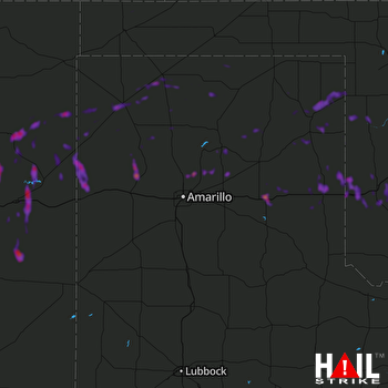 AMARILLO (KAMA) RADAR

