This weather event on July 4, 2024 includes:
3 states
27 counties,
22 cities,
and 71 zip codes.
There were 48 total properties that were impacted and have possible damage.
States Impacted By Hail On July 4, 2024
New Mexico
·
Oklahoma
·
Texas
Counties Impacted By Hail On July 4, 2024
Lea, NM
·
Roosevelt, NM
·
Beckham, OK
·
Custer, OK
·
Greer, OK
·
Harmon, OK
·
Jackson, OK
·
Kiowa, OK
·
Roger Mills, OK
·
Washita, OK
·
Bailey, TX
·
Childress, TX
·
Cochran, TX
·
Collingsworth, TX
·
Crosby, TX
·
Dickens, TX
·
Floyd, TX
·
Garza, TX
·
Hall, TX
·
Hardeman, TX
·
Hockley, TX
·
Kent, TX
·
Lubbock, TX
·
Motley, TX
·
Terry, TX
·
Wilbarger, TX
·
Yoakum, TX
Cities Impacted By Hail On July 4, 2024
Altus, OK
·
Blair, OK
·
Buffalo Springs, TX
·
Burns Flat, OK
·
Canute, OK
·
Carter, OK
·
Causey, NM
·
Eldorado, OK
·
Foss, OK
·
Friendship, OK
·
Gould, OK
·
Hollis, OK
·
Levelland, TX
·
Lone Wolf, OK
·
Lubbock, TX
·
Mangum, OK
·
Ransom Canyon, TX
·
Roaring Springs, TX
·
Slaton, TX
·
Smyer, TX
·
Whiteface, TX
·
Wolfforth, TX
Zip Codes Impacted By Hail On July 4, 2024
73521
·
73526
·
73537
·
73539
·
73544
·
73547
·
73550
·
73554
·
73560
·
73571
·
73624
·
73627
·
73641
·
73644
·
73647
·
73650
·
73655
·
73662
·
73673
·
76384
·
79095
·
79201
·
79220
·
79225
·
79230
·
79234
·
79235
·
79241
·
79244
·
79247
·
79250
·
79252
·
79256
·
79261
·
79314
·
79316
·
79322
·
79336
·
79343
·
79344
·
79345
·
79346
·
79356
·
79357
·
79363
·
79364
·
79366
·
79367
·
79371
·
79372
·
79379
·
79382
·
79403
·
79404
·
79410
·
79412
·
79413
·
79414
·
79416
·
79423
·
79424
·
79528
·
88113
·
88125
·
88126
·
88132
·
73532
·
73626
·
73664
·
79407
·
88114
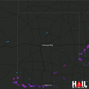 AMARILLO (KAMA) RADAR

