This weather event on July 4, 2024 includes:
3 states
28 counties,
20 cities,
and 66 zip codes.
There were total properties that were impacted and have possible damage.
States Impacted By Hail On July 4, 2024
Indiana
·
Kentucky
·
Ohio
Counties Impacted By Hail On July 4, 2024
Dubois, IN
·
Floyd, IN
·
Harrison, IN
·
Perry, IN
·
Spencer, IN
·
Bourbon, KY
·
Breckinridge, KY
·
Bullitt, KY
·
Daviess, KY
·
Franklin, KY
·
Grayson, KY
·
Hancock, KY
·
Hardin, KY
·
Harrison, KY
·
Jefferson, KY
·
Larue, KY
·
Marion, KY
·
Meade, KY
·
Nelson, KY
·
Nicholas, KY
·
Ohio, KY
·
Oldham, KY
·
Scott, KY
·
Shelby, KY
·
Spencer, KY
·
Washington, KY
·
Woodford, KY
·
Miami, OH
Cities Impacted By Hail On July 4, 2024
Anchorage, KY
·
Bellemeade, KY
·
Brandenburg, KY
·
Brooks, KY
·
Corydon, IN
·
Doe Valley, KY
·
Fort Knox, KY
·
Frankfort, KY
·
Georgetown, KY
·
Hurstbourne, KY
·
Lanesville, IN
·
Lebanon Junction, KY
·
Louisville, KY
·
Lyndon, KY
·
Maceo, KY
·
Middletown, KY
·
Radcliff, KY
·
West Point, KY
·
Whitesville, KY
·
Wildwood, KY
Zip Codes Impacted By Hail On July 4, 2024
40013
·
40014
·
40037
·
40051
·
40056
·
40069
·
40071
·
40108
·
40109
·
40111
·
40115
·
40117
·
40119
·
40121
·
40140
·
40142
·
40144
·
40145
·
40146
·
40150
·
40152
·
40165
·
40176
·
40177
·
40178
·
40222
·
40223
·
40243
·
40245
·
40272
·
40311
·
40324
·
40347
·
40361
·
40370
·
40379
·
40511
·
40601
·
41031
·
42303
·
42343
·
42348
·
42351
·
42355
·
42366
·
42368
·
42378
·
42701
·
42712
·
42724
·
42732
·
42754
·
45373
·
47112
·
47117
·
47135
·
47136
·
47515
·
47532
·
47550
·
47635
·
47542
·
45371
·
40143
·
40107
·
40004
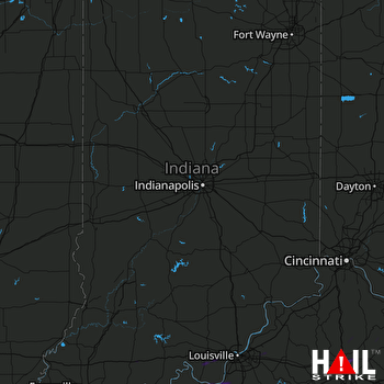 INDIANAPOLIS (KIND) RADAR

