This weather event on July 3, 2024 includes:
3 states
15 counties,
25 cities,
and 55 zip codes.
There were total properties that were impacted and have possible damage.
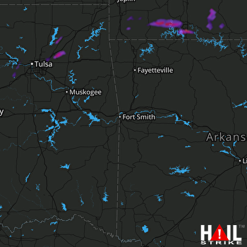 FORT SMITH (KSRX) RADAR
States Impacted By Hail On July 3, 2024
Arkansas
·
Missouri
·
Oklahoma
Counties Impacted By Hail On July 3, 2024
Conway, AR
·
Marion, AR
·
Barry, MO
·
Douglas, MO
·
McDonald, MO
·
Newton, MO
·
Ozark, MO
·
Stone, MO
·
Taney, MO
·
Creek, OK
·
Delaware, OK
·
Mayes, OK
·
Osage, OK
·
Rogers, OK
·
Tulsa, OK
Cities Impacted By Hail On July 3, 2024
Branson, MO
·
Branson West, MO
·
Bushyhead, OK
·
Butterfield, MO
·
Catoosa, OK
·
Chelsea, OK
·
Claremore, OK
·
Fairview, MO
·
Galena, MO
·
Hollister, MO
·
Indian Point, MO
·
Justice, OK
·
Kirbyville, MO
·
Lotsee, OK
·
Mannford, OK
·
McCord Bend, MO
·
Neosho, MO
·
Owasso, OK
·
Reeds Spring, MO
·
Sand Springs, OK
·
Stark City, MO
·
Tiawah, OK
·
Tulsa, OK
·
Valley Park, OK
·
Verdigris, OK
Zip Codes Impacted By Hail On July 3, 2024
64831
·
64842
·
64844
·
64850
·
64861
·
64866
·
64867
·
65605
·
65608
·
65611
·
65614
·
65616
·
65623
·
65624
·
65625
·
65627
·
65633
·
65647
·
65655
·
65656
·
65672
·
65679
·
65686
·
65708
·
65715
·
65723
·
65731
·
65733
·
65734
·
65737
·
65747
·
65761
·
65762
·
65769
·
65772
·
65773
·
72027
·
72157
·
72668
·
74010
·
74015
·
74016
·
74017
·
74019
·
74036
·
74039
·
74044
·
74055
·
74063
·
74066
·
74070
·
74344
·
74346
·
74361
·
65771

