This weather event on July 1, 2024 includes:
2 states
18 counties,
29 cities,
and 67 zip codes.
There were total properties that were impacted and have possible damage.
States Impacted By Hail On July 1, 2024
Iowa
·
Minnesota
Counties Impacted By Hail On July 1, 2024
Cerro Gordo, IA
·
Clay, IA
·
Dickinson, IA
·
Emmet, IA
·
Floyd, IA
·
Hancock, IA
·
Howard, IA
·
Kossuth, IA
·
Mitchell, IA
·
O'Brien, IA
·
Osceola, IA
·
Palo Alto, IA
·
Winnebago, IA
·
Worth, IA
·
Wright, IA
·
Faribault, MN
·
Freeborn, MN
·
Martin, MN
Cities Impacted By Hail On July 1, 2024
Algona, IA
·
Arnolds Park, IA
·
Bancroft, IA
·
Blue Earth, MN
·
Burchinal, IA
·
Burt, IA
·
Cylinder, IA
·
Dickens, IA
·
Duncan, IA
·
Emmetsburg, IA
·
Estherville, IA
·
Garner, IA
·
Graettinger, IA
·
Gruver, IA
·
Irvington, IA
·
Manly, IA
·
Milford, IA
·
Riceville, IA
·
Sexton, IA
·
St. Benedict, IA
·
Superior, IA
·
Swea City, IA
·
Terril, IA
·
Thompson, IA
·
Thornton, IA
·
Titonka, IA
·
Wahpeton, IA
·
West Okoboji, IA
·
Whittemore, IA
Zip Codes Impacted By Hail On July 1, 2024
50421
·
50423
·
50424
·
50428
·
50436
·
50438
·
50446
·
50448
·
50450
·
50451
·
50453
·
50456
·
50457
·
50459
·
50461
·
50466
·
50469
·
50471
·
50472
·
50473
·
50477
·
50478
·
50479
·
50480
·
50483
·
50484
·
50511
·
50514
·
50515
·
50517
·
50522
·
50528
·
50531
·
50536
·
50539
·
50556
·
50559
·
50560
·
50562
·
50578
·
50590
·
50598
·
51301
·
51331
·
51333
·
51334
·
51338
·
51342
·
51343
·
51345
·
51346
·
51347
·
51350
·
51351
·
51354
·
51358
·
51360
·
51363
·
51364
·
51365
·
52136
·
52155
·
56013
·
56027
·
56029
·
56121
·
56127
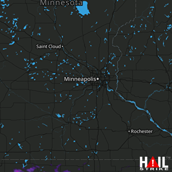 MINNEAPOLIS (KMPX) RADAR

