This weather event on July 1, 2024 includes:
2 states
10 counties,
34 cities,
and 83 zip codes.
There were total properties that were impacted and have possible damage.
States Impacted By Hail On July 1, 2024
Iowa
·
Nebraska
Counties Impacted By Hail On July 1, 2024
Mills, IA
·
Cass, NE
·
Clay, NE
·
Fillmore, NE
·
Lancaster, NE
·
Saline, NE
·
Sarpy, NE
·
Saunders, NE
·
Seward, NE
·
York, NE
Cities Impacted By Hail On July 1, 2024
Ashland, NE
·
Cedar Creek, NE
·
Ceresco, NE
·
Denton, NE
·
Dorchester, NE
·
Eagle, NE
·
Elmwood, NE
·
Exeter, NE
·
Fairmont, NE
·
Friend, NE
·
Garland, NE
·
Geneva, NE
·
Glenwood, IA
·
Goehner, NE
·
Greenwood, NE
·
Gretna, NE
·
La Platte, NE
·
Lincoln, NE
·
Louisville, NE
·
Malcolm, NE
·
Manley, NE
·
Murdock, NE
·
Murray, NE
·
Pacific Junction, IA
·
Plattsmouth, NE
·
Pleasant Dale, NE
·
Saronville, NE
·
Seward, NE
·
Springfield, NE
·
Sutton, NE
·
Walton, NE
·
Waverly, NE
·
Weeping Water, NE
·
Yankee Hill, NE
Zip Codes Impacted By Hail On July 1, 2024
51503
·
51534
·
51551
·
51561
·
51653
·
68003
·
68005
·
68017
·
68028
·
68033
·
68037
·
68042
·
68046
·
68048
·
68059
·
68066
·
68123
·
68133
·
68304
·
68313
·
68314
·
68333
·
68336
·
68339
·
68343
·
68347
·
68349
·
68351
·
68354
·
68359
·
68360
·
68361
·
68364
·
68365
·
68366
·
68402
·
68403
·
68404
·
68405
·
68406
·
68407
·
68409
·
68413
·
68416
·
68423
·
68428
·
68434
·
68436
·
68444
·
68452
·
68460
·
68461
·
68462
·
68463
·
68467
·
68502
·
68503
·
68504
·
68505
·
68507
·
68508
·
68510
·
68512
·
68514
·
68516
·
68517
·
68521
·
68522
·
68523
·
68524
·
68527
·
68528
·
68531
·
68532
·
68933
·
68935
·
68975
·
68979
·
68016
·
68058
·
68456
·
68506
·
68520
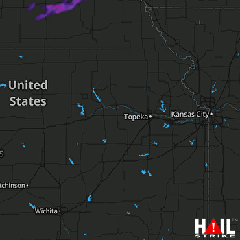 TOPEKA (KTWX) RADAR

