This weather event on June 29, 2024 includes:
4 states
22 counties,
16 cities,
and 67 zip codes.
There were 762 total properties that were impacted and have possible damage.
States Impacted By Hail On June 29, 2024
Kentucky
·
Maryland
·
Ohio
·
West Virginia
Counties Impacted By Hail On June 29, 2024
Campbell, KY
·
Garrett, MD
·
Clermont, OH
·
Gallia, OH
·
Meigs, OH
·
Barbour, WV
·
Doddridge, WV
·
Harrison, WV
·
Jackson, WV
·
Lewis, WV
·
Marion, WV
·
Mason, WV
·
Monongalia, WV
·
Preston, WV
·
Putnam, WV
·
Ritchie, WV
·
Taylor, WV
·
Tucker, WV
·
Upshur, WV
·
Wetzel, WV
·
Wirt, WV
·
Wood, WV
Cities Impacted By Hail On June 29, 2024
Anmoore, WV
·
Bridgeport, WV
·
California, KY
·
Clarksburg, WV
·
Despard, WV
·
Flemington, WV
·
Galloway, WV
·
Grafton, WV
·
Grant Town, WV
·
Harrisville, WV
·
Jane Lew, WV
·
Lost Creek, WV
·
New Richmond, OH
·
Pullman, WV
·
Rivesville, WV
·
West Union, WV
Zip Codes Impacted By Hail On June 29, 2024
21550
·
25033
·
25082
·
25123
·
25124
·
25245
·
26133
·
26143
·
26155
·
26161
·
26164
·
26167
·
26169
·
26201
·
26238
·
26287
·
26301
·
26323
·
26327
·
26330
·
26337
·
26347
·
26349
·
26354
·
26362
·
26378
·
26385
·
26386
·
26404
·
26405
·
26410
·
26411
·
26415
·
26416
·
26419
·
26421
·
26424
·
26426
·
26435
·
26436
·
26440
·
26444
·
26452
·
26456
·
26501
·
26508
·
26519
·
26525
·
26554
·
26560
·
26574
·
26581
·
26586
·
26588
·
26705
·
26716
·
41007
·
45102
·
45157
·
45614
·
45620
·
45631
·
45743
·
45760
·
45770
·
26425
·
26408
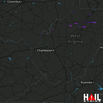 CHARLESTON (KRLX) RADAR

