This weather event on June 28, 2024 includes:
3 states
26 counties,
11 cities,
and 78 zip codes.
There were 2312 total properties that were impacted and have possible damage.
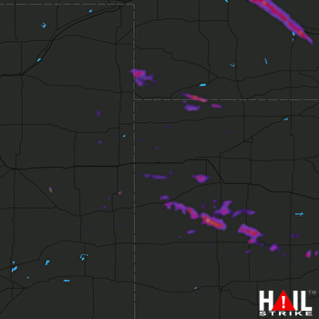 GOODLAND (KGLD) RADAR
States Impacted By Hail On June 28, 2024
Colorado
·
Kansas
·
Nebraska
Counties Impacted By Hail On June 28, 2024
Cheyenne, CO
·
Kit Carson, CO
·
Lincoln, CO
·
Yuma, CO
·
Cheyenne, KS
·
Decatur, KS
·
Gove, KS
·
Lane, KS
·
Logan, KS
·
Ness, KS
·
Pawnee, KS
·
Rawlins, KS
·
Rush, KS
·
Scott, KS
·
Sherman, KS
·
Thomas, KS
·
Wallace, KS
·
Wichita, KS
·
Chase, NE
·
Custer, NE
·
Dawson, NE
·
Dundy, NE
·
Gosper, NE
·
Hitchcock, NE
·
Lincoln, NE
·
Phelps, NE
Cities Impacted By Hail On June 28, 2024
Bird City, KS
·
Brady, NE
·
Cozad, NE
·
Dighton, KS
·
Gothenburg, NE
·
Healy, KS
·
Lexington, NE
·
Marienthal, KS
·
Max, NE
·
Wallace, KS
·
Willow Island, NE
Zip Codes Impacted By Hail On June 28, 2024
67513
·
67516
·
67518
·
67521
·
67523
·
67559
·
67560
·
67574
·
67575
·
67584
·
67701
·
67730
·
67731
·
67732
·
67734
·
67735
·
67736
·
67738
·
67739
·
67741
·
67743
·
67744
·
67745
·
67747
·
67748
·
67749
·
67753
·
67756
·
67757
·
67758
·
67761
·
67762
·
67764
·
67839
·
67846
·
67850
·
67861
·
67863
·
67871
·
68850
·
68927
·
68937
·
68958
·
68976
·
69021
·
69023
·
69030
·
69037
·
69041
·
69043
·
69045
·
69101
·
69123
·
69130
·
69138
·
69143
·
69151
·
69171
·
80727
·
80735
·
80755
·
80758
·
80759
·
80802
·
80805
·
80807
·
80810
·
80815
·
80821
·
80822
·
80824
·
80825
·
80834
·
80836
·
80861
·
67572
·
67733
·
69044

