This weather event on June 28, 2024 includes:
4 states
21 counties,
27 cities,
and 63 zip codes.
There were 404 total properties that were impacted and have possible damage.
States Impacted By Hail On June 28, 2024
Iowa
·
Kansas
·
Missouri
·
Nebraska
Counties Impacted By Hail On June 28, 2024
Audubon, IA
·
Boone, IA
·
Cass, IA
·
Dallas, IA
·
Greene, IA
·
Guthrie, IA
·
Page, IA
·
Ringgold, IA
·
Taylor, IA
·
Brown, KS
·
Marshall, KS
·
Nemaha, KS
·
Pottawatomie, KS
·
Riley, KS
·
Andrew, MO
·
Atchison, MO
·
Gentry, MO
·
Holt, MO
·
Nodaway, MO
·
Nemaha, NE
·
Richardson, NE
Cities Impacted By Hail On June 28, 2024
Atlantic, IA
·
Bedford, IA
·
Bern, KS
·
Blanchard, MO
·
Braddyville, IA
·
Centralia, KS
·
Clearfield, IA
·
Conway, IA
·
Corning, MO
·
Elmo, MO
·
Exira, IA
·
Fairfax, MO
·
Fairview, KS
·
Gravity, IA
·
Griswold, IA
·
Guthrie Center, IA
·
Hiawatha, KS
·
Jamaica, IA
·
Lake Panorama, IA
·
Leonardville, KS
·
Olsburg, KS
·
Riley, KS
·
Rippey, IA
·
Salem, NE
·
Sharpsburg, IA
·
Vermillion, KS
·
Wiota, IA
Zip Codes Impacted By Hail On June 28, 2024
50022
·
50026
·
50029
·
50042
·
50058
·
50076
·
50115
·
50128
·
50129
·
50212
·
50216
·
50235
·
50274
·
50277
·
50833
·
50840
·
50845
·
50848
·
50851
·
50862
·
51535
·
51631
·
51632
·
51646
·
64428
·
64431
·
64437
·
64445
·
64446
·
64463
·
64480
·
64482
·
64491
·
64494
·
64498
·
66404
·
66411
·
66415
·
66425
·
66427
·
66434
·
66449
·
66503
·
66515
·
66520
·
66521
·
66527
·
66531
·
66534
·
66538
·
66544
·
66549
·
66554
·
68337
·
68355
·
68376
·
68414
·
68431
·
68433
·
68437
·
68457
·
66408
·
50117
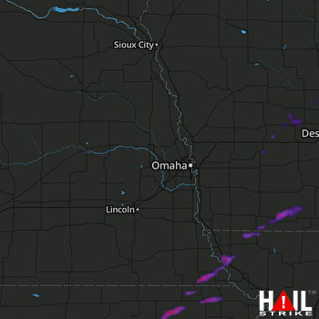 OMAHA (KOAX) RADAR

