This weather event on June 25, 2024 includes:
3 states
21 counties,
18 cities,
and 66 zip codes.
There were 252 total properties that were impacted and have possible damage.
States Impacted By Hail On June 25, 2024
Kentucky
·
Ohio
·
West Virginia
Counties Impacted By Hail On June 25, 2024
Bourbon, KY
·
Lewis, KY
·
Adams, OH
·
Athens, OH
·
Clinton, OH
·
Fairfield, OH
·
Fayette, OH
·
Franklin, OH
·
Gallia, OH
·
Hocking, OH
·
Jackson, OH
·
Lawrence, OH
·
Madison, OH
·
Meigs, OH
·
Perry, OH
·
Pickaway, OH
·
Pike, OH
·
Ross, OH
·
Scioto, OH
·
Vinton, OH
·
Mason, WV
Cities Impacted By Hail On June 25, 2024
Adelphi, OH
·
Andersonville, OH
·
Chillicothe, OH
·
Circleville, OH
·
Clarksburg, OH
·
Gallipolis Ferry, WV
·
Grove City, OH
·
Lancaster, OH
·
Laurelville, OH
·
London, OH
·
New Holland, OH
·
Pancoastburg, OH
·
Richmond Dale, OH
·
Stoutsville, OH
·
Tarlton, OH
·
Urbancrest, OH
·
Waverly, OH
·
Williamsport, OH
Zip Codes Impacted By Hail On June 25, 2024
40361
·
41179
·
43076
·
43101
·
43102
·
43103
·
43105
·
43113
·
43115
·
43123
·
43130
·
43135
·
43138
·
43140
·
43143
·
43145
·
43146
·
43148
·
43149
·
43152
·
43154
·
43155
·
43156
·
43160
·
43162
·
43164
·
43731
·
43764
·
45107
·
45144
·
45177
·
45601
·
45613
·
45614
·
45622
·
45623
·
45628
·
45629
·
45631
·
45638
·
45640
·
45644
·
45647
·
45648
·
45651
·
45653
·
45654
·
45656
·
45657
·
45658
·
45659
·
45660
·
45661
·
45671
·
45673
·
45690
·
45692
·
45693
·
45694
·
45701
·
45770
·
45771
·
25515
·
43150
·
43761
·
45616
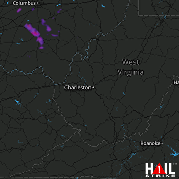 CHARLESTON (KRLX) RADAR

