This weather event on June 23, 2024 includes:
3 states
23 counties,
15 cities,
and 100 zip codes.
There were total properties that were impacted and have possible damage.
States Impacted By Hail On June 23, 2024
Massachusetts
·
New York
·
Vermont
Counties Impacted By Hail On June 23, 2024
Berkshire, MA
·
Albany, NY
·
Clinton, NY
·
Delaware, NY
·
Essex, NY
·
Franklin, NY
·
Fulton, NY
·
Herkimer, NY
·
Jefferson, NY
·
Lewis, NY
·
Oswego, NY
·
Rensselaer, NY
·
Saratoga, NY
·
Schoharie, NY
·
Seneca, NY
·
Tompkins, NY
·
Warren, NY
·
Washington, NY
·
Addison, VT
·
Bennington, VT
·
Chittenden, VT
·
Rutland, VT
·
Washington, VT
Cities Impacted By Hail On June 23, 2024
Argyle, NY
·
Ballston Spa, NY
·
Benson, VT
·
Champlain, NY
·
Greenwich, NY
·
Hinesburg, VT
·
Milton, NY
·
North Ballston Spa, NY
·
Poestenkill, NY
·
Salem, NY
·
Saratoga Springs, NY
·
Schuylerville, NY
·
Vergennes, VT
·
Victory, NY
·
West Sand Lake, NY
Zip Codes Impacted By Hail On June 23, 2024
1267
·
5201
·
5250
·
5260
·
5261
·
5352
·
5443
·
5445
·
5456
·
5461
·
5462
·
5472
·
5473
·
5477
·
5487
·
5491
·
5660
·
5673
·
5676
·
5737
·
5739
·
5743
·
5760
·
5761
·
5776
·
12009
·
12010
·
12018
·
12022
·
12023
·
12025
·
12041
·
12052
·
12054
·
12059
·
12074
·
12086
·
12122
·
12138
·
12140
·
12147
·
12153
·
12157
·
12158
·
12170
·
12186
·
12193
·
12196
·
12804
·
12809
·
12815
·
12816
·
12822
·
12823
·
12827
·
12828
·
12831
·
12832
·
12833
·
12834
·
12845
·
12850
·
12859
·
12863
·
12865
·
12866
·
12871
·
12873
·
12884
·
12913
·
12919
·
12928
·
12936
·
12946
·
12960
·
12974
·
12983
·
12989
·
13045
·
13068
·
13144
·
13325
·
13357
·
13367
·
13437
·
13471
·
13473
·
13626
·
13659
·
13755
·
13756
·
13856
·
14521
·
14847
·
14860
·
13491
·
13073
·
12159
·
12067
·
12020
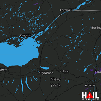 FORT DRUM (KTYX) RADAR

