This weather event on June 22, 2024 includes:
3 states
30 counties,
19 cities,
and 78 zip codes.
There were 910 total properties that were impacted and have possible damage.
States Impacted By Hail On June 22, 2024
Iowa
·
Kansas
·
Missouri
Counties Impacted By Hail On June 22, 2024
Appanoose, IA
·
Decatur, IA
·
Ringgold, IA
·
Wayne, IA
·
Brown, KS
·
Coffey, KS
·
Doniphan, KS
·
Greenwood, KS
·
Jefferson, KS
·
Johnson, KS
·
Leavenworth, KS
·
Lyon, KS
·
Miami, KS
·
Andrew, MO
·
Cass, MO
·
Clay, MO
·
Gentry, MO
·
Harrison, MO
·
Holt, MO
·
Jackson, MO
·
Linn, MO
·
Livingston, MO
·
Macon, MO
·
Mercer, MO
·
Nodaway, MO
·
Putnam, MO
·
Ray, MO
·
Schuyler, MO
·
Sullivan, MO
·
Worth, MO
Cities Impacted By Hail On June 22, 2024
Belton, MO
·
Browning, MO
·
Chillicothe, MO
·
Clio, IA
·
Decatur City, IA
·
Fillmore, MO
·
Harris, MO
·
Kansas City, MO
·
Lake Winnebago, MO
·
Lamoni, IA
·
Leawood, KS
·
Leon, IA
·
Liberty, MO
·
Maryville, MO
·
Overland Park, KS
·
Peculiar, MO
·
Raymore, MO
·
Rosendale, MO
·
Unionville, MO
Zip Codes Impacted By Hail On June 22, 2024
50008
·
50052
·
50060
·
50065
·
50067
·
50103
·
50108
·
50133
·
50140
·
50144
·
50147
·
50854
·
50863
·
52544
·
52590
·
63541
·
63551
·
63557
·
63561
·
63567
·
64012
·
64062
·
64068
·
64078
·
64080
·
64083
·
64084
·
64114
·
64145
·
64146
·
64157
·
64427
·
64442
·
64449
·
64456
·
64458
·
64466
·
64473
·
64475
·
64479
·
64480
·
64481
·
64483
·
64485
·
64486
·
64494
·
64601
·
64630
·
64632
·
64645
·
64664
·
64667
·
64671
·
64672
·
64673
·
64674
·
64688
·
64701
·
66020
·
66035
·
66048
·
66054
·
66066
·
66071
·
66094
·
66097
·
66209
·
66211
·
66223
·
66224
·
66532
·
66854
·
66856
·
66865
·
66870
·
66864
·
64468
·
63565
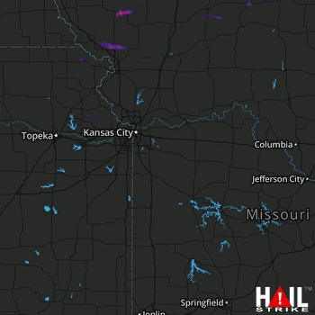 KANSAS CITY (KEAX) RADAR

