This weather event on June 22, 2024 includes:
4 states
20 counties,
28 cities,
and 71 zip codes.
There were total properties that were impacted and have possible damage.
States Impacted By Hail On June 22, 2024
Iowa
·
Kansas
·
Missouri
·
Nebraska
Counties Impacted By Hail On June 22, 2024
Boone, IA
·
Clarke, IA
·
Decatur, IA
·
Madison, IA
·
Ringgold, IA
·
Taylor, IA
·
Union, IA
·
Warren, IA
·
Brown, KS
·
Doniphan, KS
·
Andrew, MO
·
Atchison, MO
·
Buchanan, MO
·
DeKalb, MO
·
Gentry, MO
·
Harrison, MO
·
Holt, MO
·
Nodaway, MO
·
Worth, MO
·
Richardson, NE
Cities Impacted By Hail On June 22, 2024
Arispe, IA
·
Bigelow, MO
·
Big Lake, MO
·
Clearfield, IA
·
Conway, IA
·
Davis City, IA
·
Decatur City, IA
·
Diagonal, IA
·
East Peru, IA
·
Fillmore, MO
·
Grant City, MO
·
Irena, MO
·
Kellerton, IA
·
Lamoni, IA
·
Leon, IA
·
Maryville, MO
·
Mound City, MO
·
Murray, IA
·
Parnell, MO
·
Ravenwood, MO
·
Rea, MO
·
Ridgeway, MO
·
Rosendale, MO
·
Shannon City, IA
·
St. Marys, IA
·
Thayer, IA
·
Truro, IA
·
Winterset, IA
Zip Codes Impacted By Hail On June 22, 2024
50065
·
50067
·
50074
·
50108
·
50125
·
50133
·
50140
·
50144
·
50149
·
50156
·
50174
·
50210
·
50213
·
50222
·
50229
·
50240
·
50254
·
50257
·
50261
·
50273
·
50276
·
50801
·
50830
·
50833
·
50836
·
50840
·
50845
·
50851
·
50854
·
50861
·
50862
·
50863
·
64421
·
64424
·
64426
·
64437
·
64441
·
64442
·
64449
·
64451
·
64453
·
64455
·
64456
·
64458
·
64463
·
64466
·
64467
·
64468
·
64470
·
64471
·
64473
·
64479
·
64480
·
64481
·
64483
·
64484
·
64485
·
64486
·
64487
·
64494
·
64499
·
64504
·
66002
·
66035
·
66090
·
66094
·
66532
·
68431
·
64427
·
64459
·
64475
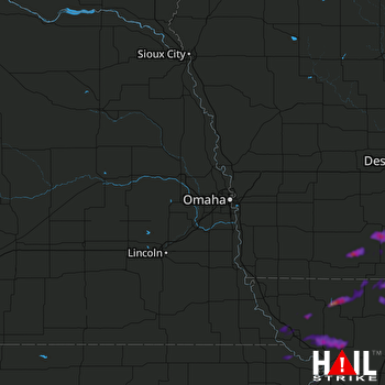 OMAHA (KOAX) RADAR

