This weather event on June 21, 2024 includes:
3 states
19 counties,
20 cities,
and 64 zip codes.
There were 49 total properties that were impacted and have possible damage.
States Impacted By Hail On June 21, 2024
Iowa
·
Nebraska
·
South Dakota
Counties Impacted By Hail On June 21, 2024
Buena Vista, IA
·
Cherokee, IA
·
Clay, IA
·
Dickinson, IA
·
O'Brien, IA
·
Osceola, IA
·
Plymouth, IA
·
Sioux, IA
·
Hall, NE
·
Hamilton, NE
·
Howard, NE
·
Merrick, NE
·
Platte, NE
·
Polk, NE
·
Sherman, NE
·
Valley, NE
·
Clay, SD
·
Lincoln, SD
·
Union, SD
Cities Impacted By Hail On June 21, 2024
Alton, IA
·
Archer, IA
·
Ashton, NE
·
Calumet, IA
·
Central City, NE
·
Everly, IA
·
Gillett Grove, IA
·
Hartley, IA
·
Hordville, NE
·
Maurice, IA
·
Melvin, IA
·
Orange City, IA
·
Overland, NE
·
Peterson, IA
·
Primghar, IA
·
Rossie, IA
·
Sanborn, IA
·
Sioux Center, IA
·
Spencer, IA
·
Sutherland, IA
Zip Codes Impacted By Hail On June 21, 2024
50585
·
51001
·
51003
·
51009
·
51012
·
51014
·
51022
·
51023
·
51027
·
51029
·
51031
·
51033
·
51035
·
51036
·
51037
·
51041
·
51046
·
51047
·
51050
·
51058
·
51201
·
51231
·
51234
·
51238
·
51239
·
51240
·
51245
·
51247
·
51248
·
51250
·
51301
·
51333
·
51338
·
51341
·
51343
·
51346
·
51350
·
51351
·
51357
·
51366
·
57001
·
57004
·
57025
·
57039
·
57077
·
68601
·
68628
·
68651
·
68654
·
68663
·
68666
·
68801
·
68803
·
68815
·
68816
·
68817
·
68826
·
68827
·
68846
·
68853
·
68854
·
68871
·
68872
·
68873
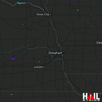 OMAHA (KOAX) RADAR

