This weather event on June 17, 2024 includes:
5 states
25 counties,
24 cities,
and 76 zip codes.
There were 48 total properties that were impacted and have possible damage.
States Impacted By Hail On June 17, 2024
Illinois
·
Indiana
·
Kentucky
·
Michigan
·
Ohio
Counties Impacted By Hail On June 17, 2024
Coles, IL
·
Cumberland, IL
·
Kankakee, IL
·
Will, IL
·
Benton, IN
·
Decatur, IN
·
Delaware, IN
·
Jasper, IN
·
LaPorte, IN
·
Newton, IN
·
Porter, IN
·
Spencer, IN
·
Starke, IN
·
St. Joseph, IN
·
Warrick, IN
·
Wayne, IN
·
Harrison, KY
·
Berrien, MI
·
Cass, MI
·
Brown, OH
·
Butler, OH
·
Clinton, OH
·
Highland, OH
·
Montgomery, OH
·
Warren, OH
Cities Impacted By Hail On June 17, 2024
Buford, OH
·
Centerville, IN
·
Charleston, IL
·
Clarksville, OH
·
Darrtown, OH
·
Dayton, OH
·
Germantown, OH
·
Granger, IN
·
Harveysburg, OH
·
Indian Village, IN
·
Kettering, OH
·
La Crosse, IN
·
Manteno, IL
·
Mishawaka, IN
·
Monee, IL
·
Moraine, OH
·
Mount Orab, OH
·
Notre Dame, IN
·
Oakwood, OH
·
Rensselaer, IN
·
Riverside, OH
·
Roseland, IN
·
South Bend, IN
·
West Carrollton, OH
Zip Codes Impacted By Hail On June 17, 2024
40370
·
41031
·
45032
·
45056
·
45068
·
45113
·
45152
·
45154
·
45171
·
45177
·
45327
·
45342
·
45402
·
45403
·
45404
·
45405
·
45406
·
45409
·
45410
·
45414
·
45417
·
45418
·
45419
·
45420
·
45429
·
45431
·
45439
·
45449
·
46340
·
46347
·
46348
·
46366
·
46374
·
46382
·
46390
·
46392
·
46530
·
46532
·
46534
·
46556
·
46616
·
46628
·
46635
·
46637
·
47240
·
47330
·
47336
·
47338
·
47357
·
47374
·
47523
·
47537
·
47601
·
47611
·
47634
·
47637
·
47922
·
47970
·
47971
·
47975
·
47978
·
49120
·
60449
·
60468
·
60950
·
61912
·
61920
·
61938
·
61943
·
62440
·
62474
·
60914
·
47635
·
47345
·
45345
·
45054
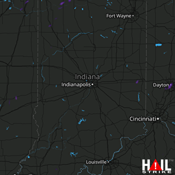 INDIANAPOLIS (KIND) RADAR

