This weather event on June 15, 2024 includes:
4 states
32 counties,
17 cities,
and 79 zip codes.
There were 3081 total properties that were impacted and have possible damage.
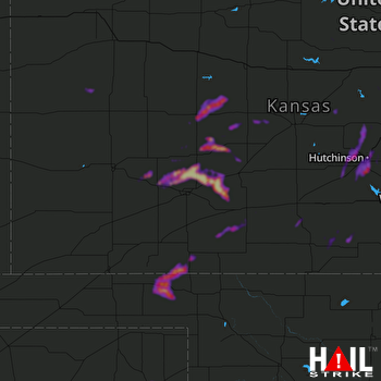 DODGE CITY (KDDC) RADAR
States Impacted By Hail On June 15, 2024
Colorado
·
Kansas
·
Oklahoma
·
Texas
Counties Impacted By Hail On June 15, 2024
Cheyenne, CO
·
Barber, KS
·
Barton, KS
·
Clark, KS
·
Comanche, KS
·
Edwards, KS
·
Ellsworth, KS
·
Finney, KS
·
Ford, KS
·
Gray, KS
·
Harper, KS
·
Harvey, KS
·
Hodgeman, KS
·
Kingman, KS
·
Kiowa, KS
·
Lane, KS
·
Lincoln, KS
·
Logan, KS
·
McPherson, KS
·
Meade, KS
·
Ness, KS
·
Pawnee, KS
·
Pratt, KS
·
Reno, KS
·
Rice, KS
·
Rush, KS
·
Saline, KS
·
Scott, KS
·
Wichita, KS
·
Beaver, OK
·
Hemphill, TX
·
Roberts, TX
Cities Impacted By Hail On June 15, 2024
Abbyville, KS
·
Arlington, KS
·
Cimarron, KS
·
Falun, KS
·
Frederick, KS
·
Hutchinson, KS
·
Jetmore, KS
·
McCracken, KS
·
Ness City, KS
·
Nickerson, KS
·
Ransom, KS
·
Salina, KS
·
Sawyer, KS
·
Sharon, KS
·
South Hutchinson, KS
·
Spearville, KS
·
Yoder, KS
Zip Codes Impacted By Hail On June 15, 2024
67009
·
67020
·
67028
·
67029
·
67054
·
67057
·
67058
·
67059
·
67109
·
67124
·
67127
·
67134
·
67138
·
67159
·
67401
·
67442
·
67444
·
67452
·
67455
·
67456
·
67457
·
67459
·
67481
·
67491
·
67501
·
67502
·
67505
·
67510
·
67511
·
67513
·
67514
·
67516
·
67521
·
67522
·
67523
·
67530
·
67543
·
67546
·
67547
·
67550
·
67554
·
67556
·
67559
·
67560
·
67561
·
67563
·
67566
·
67567
·
67570
·
67572
·
67574
·
67575
·
67579
·
67581
·
67583
·
67764
·
67801
·
67831
·
67835
·
67839
·
67840
·
67849
·
67853
·
67854
·
67864
·
67871
·
67876
·
67882
·
73844
·
73848
·
73932
·
73938
·
79014
·
79059
·
80802
·
67427
·
67460
·
67834
·
67863

