This weather event on June 13, 2024 includes:
3 states
16 counties,
24 cities,
and 57 zip codes.
There were total properties that were impacted and have possible damage.
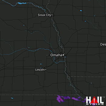 OMAHA (KOAX) RADAR
States Impacted By Hail On June 13, 2024
Kansas
·
Missouri
·
Nebraska
Counties Impacted By Hail On June 13, 2024
Brown, KS
·
Clay, KS
·
Doniphan, KS
·
Jackson, KS
·
Jefferson, KS
·
Marshall, KS
·
Nemaha, KS
·
Pottawatomie, KS
·
Riley, KS
·
Andrew, MO
·
Buchanan, MO
·
Clinton, MO
·
DeKalb, MO
·
Holt, MO
·
Pawnee, NE
·
Richardson, NE
Cities Impacted By Hail On June 13, 2024
Agency, MO
·
Axtell, KS
·
Baileyville, KS
·
Bern, KS
·
Clarksdale, MO
·
Cosby, MO
·
Country Club, MO
·
De Kalb, MO
·
Denison, KS
·
Easton, MO
·
Elwood, KS
·
Emmett, KS
·
Hamlin, KS
·
Hiawatha, KS
·
Holton, KS
·
Morrill, KS
·
Oneida, KS
·
Robinson, KS
·
Rushville, MO
·
Sabetha, KS
·
Seneca, KS
·
St. Joseph, MO
·
Troy, KS
·
Valley Falls, KS
Zip Codes Impacted By Hail On June 13, 2024
64401
·
64421
·
64430
·
64436
·
64440
·
64443
·
64448
·
64451
·
64473
·
64484
·
64485
·
64490
·
64501
·
64503
·
64504
·
64505
·
64506
·
64507
·
66002
·
66008
·
66024
·
66035
·
66087
·
66088
·
66090
·
66094
·
66403
·
66404
·
66407
·
66408
·
66415
·
66417
·
66418
·
66419
·
66422
·
66425
·
66428
·
66432
·
66434
·
66436
·
66440
·
66449
·
66509
·
66515
·
66522
·
66531
·
66532
·
66534
·
66536
·
66538
·
66540
·
67432
·
68355
·
68420
·
66547
·
66521
·
64454

