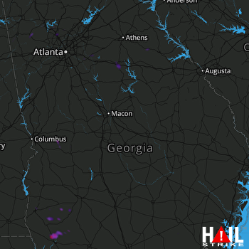
This weather event on June 2, 2024 includes:
2 states
32 counties,
20 cities,
and 67 zip codes.
There were 92 total properties that were impacted and have possible damage.
States Impacted By Hail On June 2, 2024
Alabama
·
Georgia
Counties Impacted By Hail On June 2, 2024
Chambers, AL
·
Henry, AL
·
Macon, AL
·
Tallapoosa, AL
·
Baker, GA
·
Bartow, GA
·
Calhoun, GA
·
Cherokee, GA
·
Clarke, GA
·
Cobb, GA
·
Decatur, GA
·
DeKalb, GA
·
Dougherty, GA
·
Early, GA
·
Fulton, GA
·
Grady, GA
·
Lee, GA
·
Marion, GA
·
Miller, GA
·
Mitchell, GA
·
Morgan, GA
·
Muscogee, GA
·
Newton, GA
·
Oconee, GA
·
Oglethorpe, GA
·
Polk, GA
·
Rockdale, GA
·
Schley, GA
·
Taylor, GA
·
Walton, GA
·
Ware, GA
·
Wilkes, GA
Cities Impacted By Hail On June 2, 2024
Albany, GA
·
Arlington, GA
·
Arnoldsville, GA
·
Athens-Clarke County unified government (balance), GA
·
Blakely, GA
·
Buena Vista, GA
·
Camp Hill, AL
·
Cartersville, GA
·
Cedartown, GA
·
Columbus, GA
·
Conyers, GA
·
Damascus, GA
·
Madison, GA
·
Milton, GA
·
Mountain Park, GA
·
Rayle, GA
·
Rockmart, GA
·
Roswell, GA
·
Tuskegee, AL
·
Woodstock, GA
Zip Codes Impacted By Hail On June 2, 2024
30012
·
30013
·
30014
·
30025
·
30038
·
30052
·
30054
·
30060
·
30062
·
30064
·
30075
·
30094
·
30102
·
30104
·
30114
·
30120
·
30121
·
30144
·
30153
·
30178
·
30188
·
30189
·
30605
·
30619
·
30621
·
30630
·
30648
·
30650
·
30655
·
30660
·
30663
·
30677
·
30683
·
31058
·
31081
·
31503
·
31701
·
31707
·
31721
·
31730
·
31763
·
31779
·
31801
·
31803
·
31806
·
31820
·
36075
·
36083
·
36319
·
36373
·
36850
·
36853
·
36862
·
39813
·
39817
·
39823
·
39824
·
39825
·
39834
·
39837
·
39841
·
39862
·
39870
·
39897
·
30625
·
30125
·
30066
 ROBINS AFB (KJGX) RADAR

