This weather event on May 31, 2024 includes:
2 states
26 counties,
10 cities,
and 57 zip codes.
There were 262 total properties that were impacted and have possible damage.
States Impacted By Hail On May 31, 2024
Kansas
·
Oklahoma
Counties Impacted By Hail On May 31, 2024
Barber, KS
·
Clark, KS
·
Comanche, KS
·
Edwards, KS
·
Finney, KS
·
Ford, KS
·
Grant, KS
·
Gray, KS
·
Greeley, KS
·
Hamilton, KS
·
Haskell, KS
·
Hodgeman, KS
·
Kearny, KS
·
Kiowa, KS
·
Lane, KS
·
Logan, KS
·
Meade, KS
·
Ness, KS
·
Rush, KS
·
Scott, KS
·
Seward, KS
·
Stevens, KS
·
Trego, KS
·
Wichita, KS
·
Alfalfa, OK
·
Woods, OK
Cities Impacted By Hail On May 31, 2024
Copeland, KS
·
Dighton, KS
·
Garden City, KS
·
Greeley County unified government (balance), KS
·
Ingalls, KS
·
Lambert, OK
·
Leoti, KS
·
Marienthal, KS
·
Offerle, KS
·
Scott City, KS
Zip Codes Impacted By Hail On May 31, 2024
67054
·
67057
·
67059
·
67070
·
67109
·
67127
·
67155
·
67513
·
67515
·
67516
·
67518
·
67521
·
67547
·
67556
·
67559
·
67560
·
67563
·
67572
·
67584
·
67637
·
67656
·
67672
·
67747
·
67748
·
67801
·
67831
·
67834
·
67835
·
67837
·
67839
·
67841
·
67842
·
67844
·
67846
·
67850
·
67853
·
67854
·
67859
·
67860
·
67861
·
67863
·
67865
·
67867
·
67868
·
67870
·
67871
·
67876
·
67878
·
67879
·
67880
·
67882
·
67952
·
73717
·
73722
·
73728
·
73749
·
73842
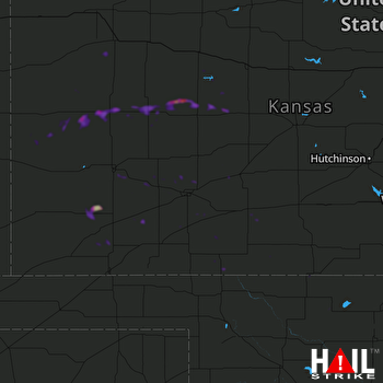 DODGE CITY (KDDC) RADAR

