This weather event on May 31, 2024 includes:
2 states
28 counties,
22 cities,
and 82 zip codes.
There were 344 total properties that were impacted and have possible damage.
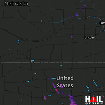 HASTINGS (KUEX) RADAR
States Impacted By Hail On May 31, 2024
Kansas
·
Nebraska
Counties Impacted By Hail On May 31, 2024
Jewell, KS
·
Lincoln, KS
·
Marion, KS
·
McPherson, KS
·
Mitchell, KS
·
Osborne, KS
·
Ottawa, KS
·
Republic, KS
·
Russell, KS
·
Saline, KS
·
Smith, KS
·
Washington, KS
·
Butler, NE
·
Colfax, NE
·
Cuming, NE
·
Fillmore, NE
·
Jefferson, NE
·
Madison, NE
·
Merrick, NE
·
Nance, NE
·
Pierce, NE
·
Platte, NE
·
Polk, NE
·
Stanton, NE
·
Thayer, NE
·
Wayne, NE
·
Webster, NE
·
York, NE
Cities Impacted By Hail On May 31, 2024
Assaria, KS
·
Barnard, KS
·
Canton, KS
·
Columbus, NE
·
Culver, KS
·
Falun, KS
·
Genoa, NE
·
Hubbell, NE
·
Hunter, KS
·
Lakeview, NE
·
Leigh, NE
·
Lindsborg, KS
·
McPherson, KS
·
Monroe, NE
·
Platte Center, NE
·
Roxbury, KS
·
Russell, KS
·
Salina, KS
·
Smolan, KS
·
Tipton, KS
·
Woodland Park, NE
·
York, NE
Zip Codes Impacted By Hail On May 31, 2024
66930
·
66936
·
66938
·
66940
·
66941
·
66944
·
66949
·
66952
·
66955
·
66956
·
66959
·
66960
·
66964
·
67073
·
67401
·
67416
·
67418
·
67420
·
67423
·
67425
·
67430
·
67437
·
67438
·
67442
·
67443
·
67448
·
67452
·
67455
·
67456
·
67460
·
67464
·
67467
·
67470
·
67473
·
67474
·
67481
·
67484
·
67485
·
67546
·
67626
·
67651
·
67658
·
67665
·
67673
·
68303
·
68315
·
68319
·
68322
·
68325
·
68326
·
68327
·
68338
·
68352
·
68367
·
68370
·
68375
·
68444
·
68467
·
68601
·
68624
·
68628
·
68629
·
68631
·
68640
·
68641
·
68642
·
68643
·
68647
·
68651
·
68653
·
68660
·
68661
·
68663
·
68666
·
68701
·
68740
·
68790
·
68930
·
68957
·
68632
·
68416
·
67428

