This weather event on May 31, 2024 includes:
1 states
17 counties,
16 cities,
and 52 zip codes.
There were 1595 total properties that were impacted and have possible damage.
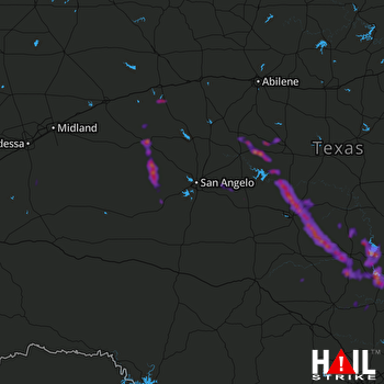 SAN ANGELO (KSJT) RADAR
States Impacted By Hail On May 31, 2024
Texas
Counties Impacted By Hail On May 31, 2024
Blanco, TX
·
Burnet, TX
·
Coleman, TX
·
Concho, TX
·
Fisher, TX
·
Gillespie, TX
·
Irion, TX
·
Llano, TX
·
Lynn, TX
·
Mason, TX
·
McCulloch, TX
·
Mitchell, TX
·
Runnels, TX
·
San Saba, TX
·
Sterling, TX
·
Tom Green, TX
·
Upton, TX
Cities Impacted By Hail On May 31, 2024
Brady, TX
·
Buchanan Dam, TX
·
Buchanan Lake Village, TX
·
Cottonwood Shores, TX
·
Eden, TX
·
Granite Shoals, TX
·
Highland Haven, TX
·
Horseshoe Bay, TX
·
Kingsland, TX
·
Llano, TX
·
Marble Falls, TX
·
Mertzon, TX
·
Round Mountain, TX
·
Sterling City, TX
·
Stonewall, TX
·
Sunrise Beach Village, TX
Zip Codes Impacted By Hail On May 31, 2024
76821
·
76824
·
76825
·
76832
·
76834
·
76836
·
76837
·
76845
·
76852
·
76856
·
76861
·
76866
·
76869
·
76871
·
76872
·
76873
·
76877
·
76878
·
76882
·
76884
·
76885
·
76887
·
76888
·
76901
·
76905
·
76937
·
76940
·
76941
·
76951
·
76958
·
78607
·
78609
·
78611
·
78618
·
78624
·
78635
·
78636
·
78639
·
78643
·
78654
·
78657
·
78663
·
78671
·
78675
·
79373
·
79512
·
79543
·
79556
·
79567
·
76820
·
76842
·
78672

