This weather event on May 30, 2024 includes:
4 states
31 counties,
10 cities,
and 51 zip codes.
There were 1048 total properties that were impacted and have possible damage.
States Impacted By Hail On May 30, 2024
Colorado
·
Kansas
·
Oklahoma
·
Texas
Counties Impacted By Hail On May 30, 2024
Cheyenne, CO
·
Kiowa, CO
·
Kit Carson, CO
·
Prowers, CO
·
Decatur, KS
·
Finney, KS
·
Gove, KS
·
Gray, KS
·
Greeley, KS
·
Hamilton, KS
·
Hodgeman, KS
·
Lane, KS
·
Logan, KS
·
Meade, KS
·
Morton, KS
·
Scott, KS
·
Seward, KS
·
Sherman, KS
·
Stanton, KS
·
Stevens, KS
·
Thomas, KS
·
Wallace, KS
·
Wichita, KS
·
Beaver, OK
·
Ellis, OK
·
Roger Mills, OK
·
Texas, OK
·
Hemphill, TX
·
Lipscomb, TX
·
Ochiltree, TX
·
Roberts, TX
Cities Impacted By Hail On May 30, 2024
Cimarron, KS
·
Colby, KS
·
Dighton, KS
·
Granada, CO
·
Greeley County unified government (balance), KS
·
Liberal, KS
·
Marienthal, KS
·
Oakley, KS
·
Russell Springs, KS
·
Tyrone, OK
Zip Codes Impacted By Hail On May 30, 2024
67701
·
67732
·
67733
·
67734
·
67735
·
67736
·
67738
·
67743
·
67748
·
67749
·
67758
·
67761
·
67762
·
67764
·
67835
·
67836
·
67839
·
67854
·
67855
·
67859
·
67861
·
67862
·
67863
·
67869
·
67871
·
67878
·
67879
·
67901
·
67951
·
67952
·
67954
·
73628
·
73660
·
73843
·
73844
·
73848
·
73932
·
73938
·
73951
·
79011
·
79014
·
79034
·
79059
·
79070
·
80807
·
81041
·
81047
·
81052
·
81071
·
67747
·
80802
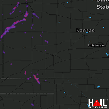 DODGE CITY (KDDC) RADAR

