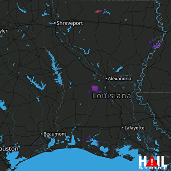
This weather event on May 29, 2024 includes:
4 states
27 counties,
12 cities,
and 72 zip codes.
There were 673 total properties that were impacted and have possible damage.
States Impacted By Hail On May 29, 2024
Arkansas
·
Louisiana
·
Mississippi
·
Texas
Counties Impacted By Hail On May 29, 2024
Columbia, AR
·
Acadia, LA
·
Avoyelles, LA
·
Bienville, LA
·
Calcasieu, LA
·
Caldwell, LA
·
Cameron, LA
·
Catahoula, LA
·
Claiborne, LA
·
Concordia, LA
·
Evangeline, LA
·
Franklin, LA
·
Lafayette, LA
·
Lincoln, LA
·
Madison, LA
·
Rapides, LA
·
Richland, LA
·
St. Landry, LA
·
Tensas, LA
·
Union, LA
·
Vermilion, LA
·
Vernon, LA
·
Adams, MS
·
Claiborne, MS
·
Jefferson, MS
·
Warren, MS
·
Jefferson, TX
Cities Impacted By Hail On May 29, 2024
Bernice, LA
·
Center Point, LA
·
Emerson, AR
·
Fayette, MS
·
Forest Hill, LA
·
Gibsland, LA
·
Glenmora, LA
·
McNary, LA
·
Opelousas, LA
·
Pitkin, LA
·
Turkey Creek, LA
·
Woodworth, LA
Zip Codes Impacted By Hail On May 29, 2024
39069
·
39086
·
39150
·
39175
·
39180
·
70512
·
70515
·
70520
·
70525
·
70535
·
70542
·
70548
·
70549
·
70570
·
70585
·
70586
·
70607
·
70630
·
70631
·
70632
·
70643
·
70656
·
70665
·
70669
·
71028
·
71219
·
71222
·
71232
·
71235
·
71241
·
71243
·
71259
·
71277
·
71282
·
71295
·
71302
·
71303
·
71316
·
71325
·
71331
·
71336
·
71341
·
71343
·
71346
·
71350
·
71354
·
71357
·
71360
·
71366
·
71367
·
71373
·
71375
·
71378
·
71418
·
71424
·
71430
·
71433
·
71438
·
71446
·
71463
·
71466
·
71472
·
71485
·
71740
·
71753
·
77622
·
77629
·
77665
·
77705
·
71351
·
71323
·
39120
 FORT POLK (KPOE) RADAR

