This weather event on May 26, 2024 includes:
3 states
22 counties,
12 cities,
and 62 zip codes.
There were 14735 total properties that were impacted and have possible damage.
States Impacted By Hail On May 26, 2024
Arkansas
·
Louisiana
·
Texas
Counties Impacted By Hail On May 26, 2024
Calhoun, AR
·
Clark, AR
·
Dallas, AR
·
Grant, AR
·
Hot Spring, AR
·
Miller, AR
·
Ouachita, AR
·
Pike, AR
·
Bossier, LA
·
Caddo, LA
·
Caldwell, LA
·
Catahoula, LA
·
Concordia, LA
·
De Soto, LA
·
Franklin, LA
·
LaSalle, LA
·
Tensas, LA
·
Bowie, TX
·
Cass, TX
·
Marion, TX
·
Morris, TX
·
Titus, TX
Cities Impacted By Hail On May 26, 2024
Gum Springs, AR
·
Gurdon, AR
·
Hampton, AR
·
Ida, LA
·
Lakeview, LA
·
Monterey, LA
·
Naples, TX
·
Queen City, TX
·
Rodessa, LA
·
Shreveport, LA
·
Sicily Island, LA
·
Sparkman, AR
Zip Codes Impacted By Hail On May 26, 2024
71004
·
71027
·
71044
·
71047
·
71052
·
71060
·
71061
·
71069
·
71078
·
71082
·
71103
·
71106
·
71107
·
71108
·
71109
·
71112
·
71115
·
71118
·
71119
·
71129
·
71243
·
71326
·
71336
·
71340
·
71343
·
71354
·
71368
·
71375
·
71378
·
71418
·
71425
·
71435
·
71441
·
71465
·
71743
·
71744
·
71763
·
71766
·
71834
·
71923
·
71929
·
71962
·
72057
·
72084
·
72104
·
72150
·
75455
·
75551
·
75555
·
75556
·
75558
·
75559
·
75560
·
75565
·
75566
·
75568
·
75571
·
75572
·
75574
·
75657
·
71940
·
71720
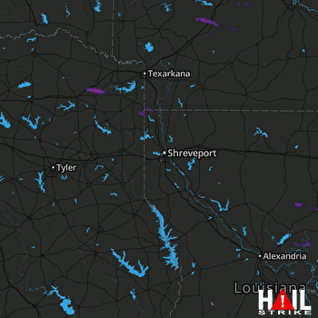 SHREVEPORT (KSHV) RADAR

