This weather event on May 25, 2024 includes:
3 states
19 counties,
30 cities,
and 50 zip codes.
There were total properties that were impacted and have possible damage.
States Impacted By Hail On May 25, 2024
Maryland
·
North Carolina
·
Virginia
Counties Impacted By Hail On May 25, 2024
Charles, MD
·
Duplin, NC
·
Franklin, NC
·
Greene, NC
·
Johnston, NC
·
Lenoir, NC
·
Nash, NC
·
Wake, NC
·
Wayne, NC
·
Culpeper, VA
·
Fairfax, VA
·
Fauquier, VA
·
Loudoun, VA
·
Madison, VA
·
Manassas, VA
·
Manassas Park, VA
·
Prince William, VA
·
Rappahannock, VA
·
Warren, VA
Cities Impacted By Hail On May 25, 2024
Archer Lodge, NC
·
Bryans Road, MD
·
Buckhall, VA
·
Clayton, NC
·
County Center, VA
·
Crosspointe, VA
·
Dranesville, VA
·
Floris, VA
·
Franklin Farm, VA
·
Goldsboro, NC
·
Great Falls, VA
·
Herndon, VA
·
Jackson Heights, NC
·
Kenly, NC
·
Kinston, NC
·
Lake Ridge, VA
·
Laurel Hill, VA
·
Lorton, VA
·
Lowes Island, VA
·
Manassas, VA
·
Manassas Park, VA
·
Mason Neck, VA
·
McNair, VA
·
Middleburg, VA
·
Reston, VA
·
Seven Springs, NC
·
Sterling, VA
·
Sugarland Run, VA
·
Wilson's Mills, NC
·
Zebulon, NC
Zip Codes Impacted By Hail On May 25, 2024
20105
·
20106
·
20110
·
20111
·
20112
·
20117
·
20124
·
20151
·
20164
·
20165
·
20166
·
20170
·
20171
·
20190
·
20191
·
20616
·
20640
·
22039
·
22066
·
22079
·
22192
·
22630
·
22642
·
22713
·
22716
·
22737
·
22740
·
22743
·
22749
·
27520
·
27527
·
27530
·
27531
·
27534
·
27542
·
27576
·
27577
·
27597
·
27863
·
28333
·
28349
·
28365
·
28398
·
28504
·
28525
·
28551
·
28578
·
28580
·
28508
·
20152
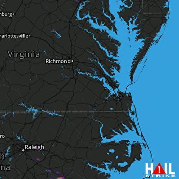 NORFOLK/RICH (KAKQ) RADAR

