This weather event on May 25, 2024 includes:
3 states
27 counties,
16 cities,
and 56 zip codes.
There were 513 total properties that were impacted and have possible damage.
States Impacted By Hail On May 25, 2024
Georgia
·
North Carolina
·
South Carolina
Counties Impacted By Hail On May 25, 2024
Jenkins, GA
·
Alexander, NC
·
Alleghany, NC
·
Ashe, NC
·
Burke, NC
·
Caldwell, NC
·
Catawba, NC
·
Cleveland, NC
·
Davie, NC
·
Gaston, NC
·
Iredell, NC
·
Lincoln, NC
·
Mecklenburg, NC
·
Rowan, NC
·
Union, NC
·
Wilkes, NC
·
Yadkin, NC
·
Calhoun, SC
·
Chesterfield, SC
·
Clarendon, SC
·
Darlington, SC
·
Kershaw, SC
·
Lancaster, SC
·
Lee, SC
·
Marlboro, SC
·
Richland, SC
·
Sumter, SC
Cities Impacted By Hail On May 25, 2024
Connelly Springs, NC
·
Dallas, NC
·
East Sumter, SC
·
Gastonia, NC
·
Granite Falls, NC
·
Hickory, NC
·
Lenoir, NC
·
Millers Creek, NC
·
Mint Hill, NC
·
Northlakes, NC
·
North Wilkesboro, NC
·
Sawmills, NC
·
Shelby, NC
·
Stanley, NC
·
Sumter, SC
·
Taylorsville, NC
Zip Codes Impacted By Hail On May 25, 2024
27013
·
27020
·
27028
·
27055
·
28016
·
28034
·
28054
·
28056
·
28073
·
28079
·
28080
·
28092
·
28104
·
28120
·
28150
·
28152
·
28164
·
28227
·
28601
·
28611
·
28612
·
28623
·
28630
·
28634
·
28638
·
28645
·
28650
·
28651
·
28659
·
28665
·
28675
·
28681
·
28694
·
28697
·
29030
·
29040
·
29044
·
29051
·
29058
·
29062
·
29078
·
29080
·
29104
·
29128
·
29135
·
29148
·
29150
·
29153
·
29161
·
29512
·
29520
·
29532
·
29593
·
30442
·
28625
·
28052
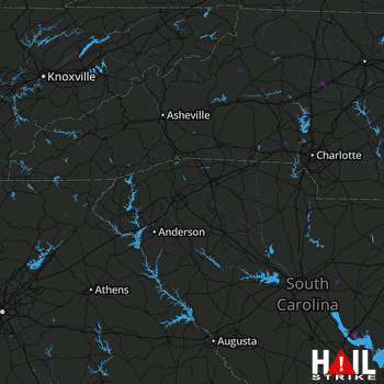 GREER (KGSP) RADAR

