This weather event on May 23, 2024 includes:
1 states
11 counties,
18 cities,
and 109 zip codes.
There were 1093 total properties that were impacted and have possible damage.
States Impacted By Hail On May 23, 2024
Maine
Counties Impacted By Hail On May 23, 2024
Aroostook, ME
·
Franklin, ME
·
Hancock, ME
·
Kennebec, ME
·
Knox, ME
·
Lincoln, ME
·
Penobscot, ME
·
Piscataquis, ME
·
Somerset, ME
·
Waldo, ME
·
Washington, ME
Cities Impacted By Hail On May 23, 2024
Anson, ME
·
Bucksport, ME
·
Calais, ME
·
Caribou, ME
·
Clinton, ME
·
Fairfield, ME
·
Fort Fairfield, ME
·
Greenville, ME
·
Lincoln, ME
·
Madison, ME
·
Presque Isle, ME
·
Skowhegan, ME
·
Unity, ME
·
Van Buren, ME
·
Washburn, ME
·
Waterville, ME
·
Winslow, ME
·
Winterport, ME
Zip Codes Impacted By Hail On May 23, 2024
4330
·
4348
·
4354
·
4401
·
4411
·
4414
·
4415
·
4416
·
4419
·
4424
·
4426
·
4438
·
4441
·
4442
·
4443
·
4444
·
4448
·
4457
·
4461
·
4462
·
4463
·
4464
·
4471
·
4472
·
4476
·
4490
·
4496
·
4497
·
4574
·
4605
·
4619
·
4666
·
4671
·
4686
·
4694
·
4730
·
4732
·
4733
·
4734
·
4735
·
4736
·
4739
·
4742
·
4743
·
4746
·
4747
·
4750
·
4757
·
4760
·
4761
·
4762
·
4763
·
4764
·
4765
·
4768
·
4769
·
4772
·
4773
·
4774
·
4776
·
4777
·
4779
·
4780
·
4358
·
4429
·
4460
·
4766
·
4781
·
4912
·
4783
·
4785
·
4786
·
4862
·
4901
·
4910
·
4911
·
4915
·
4920
·
4921
·
4922
·
4924
·
4927
·
4929
·
4932
·
4937
·
4938
·
4941
·
4947
·
4949
·
4950
·
4951
·
4952
·
4956
·
4957
·
4958
·
4961
·
4962
·
4965
·
4967
·
4969
·
4973
·
4974
·
4976
·
4979
·
4981
·
4986
·
4987
·
4988
·
4989
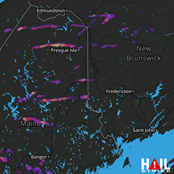 HOULTON (KCBW) RADAR

